After we spent some time in Arizona, we drove to Southern California. That's a big drive---why came to Cali? We wanted to check out Anza Borrego Desert State Park!
 |
| rainbow |
It was VERY unusual when we were entering CA. It was raining. Rain in CA?! Whoa. My entire time in CA was in the severe drought. No rain at all. A bit shocking to see rain in CA, but rain was over soon and the rainbow welcomed us in the Anza Borrego.
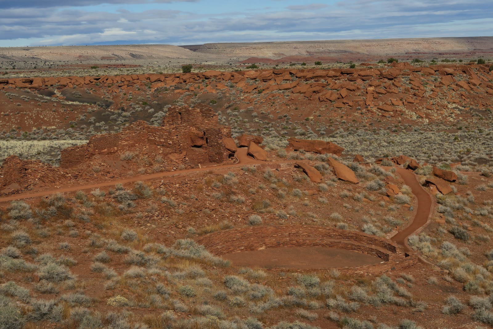
First hike we took was Calcite mine. As the name indicates, this is the hike to go to an old mine area. This is 4 mile round trip. There is a 4WD road to walk: well, you need to know that most of the "trail" here in the Anza Borrego is a dirt road---and 4WD vehicles used them. If you have a normal vehicle, you have to hike. This park is huge and has massive spider network of 4WD road in it. With 4WD you drive very very deep into canyon and you are allowed to camp anywhere. That would be extremely fun and able to have quite solitude. There are some actual hiking trail, too. Also, of course main roads are paved.
So, calcite mine. Whoa, I really liked the scenery. Numerous hills have great lightning. Very interesting colors. Calcite mine area had many white nice stones with mineral people wanted in the past (I guess). Interesting.

Calcite
After this calcite mine hike in the morning we checked into the Borrego Palm Canyon campground. Campground is spacious and cozy. Most people were camping with RV and we were the only one having a tent outside in December. Compared to Utah, it was nothing for us.
|
| Calcite |
 |
| Calcite |
 |
| Calcite |
Next, we headed for a hike "the slot". I found this interesting by hiking App before the trip. Also by searching the internet, small section of 4WD road of the trailhead is doable with 2WD. We found that the road is good condition and reached the trailhead without any problem. Then....this should be a popular hike, but no car in the parking lot. Found that the trail was closed! No sign at the turn off to the dirt road from paved road.
 |
| The slot |
OK fine---let's go to the next hike. We next headed for William Kenyon Overlook trail--1 mile round trip. This is near another campground (Yaqui Pass campground). The view was gorgeous. Nobody was hiking there and it was absolutely ours. In the afternoon even not much cars were on the road. Quite peacefully I very much enjoyed the scene: nice warm sun hitting the immense desert.
 |
| William Kenyon Overlook |

Before sunrise
Sun coming
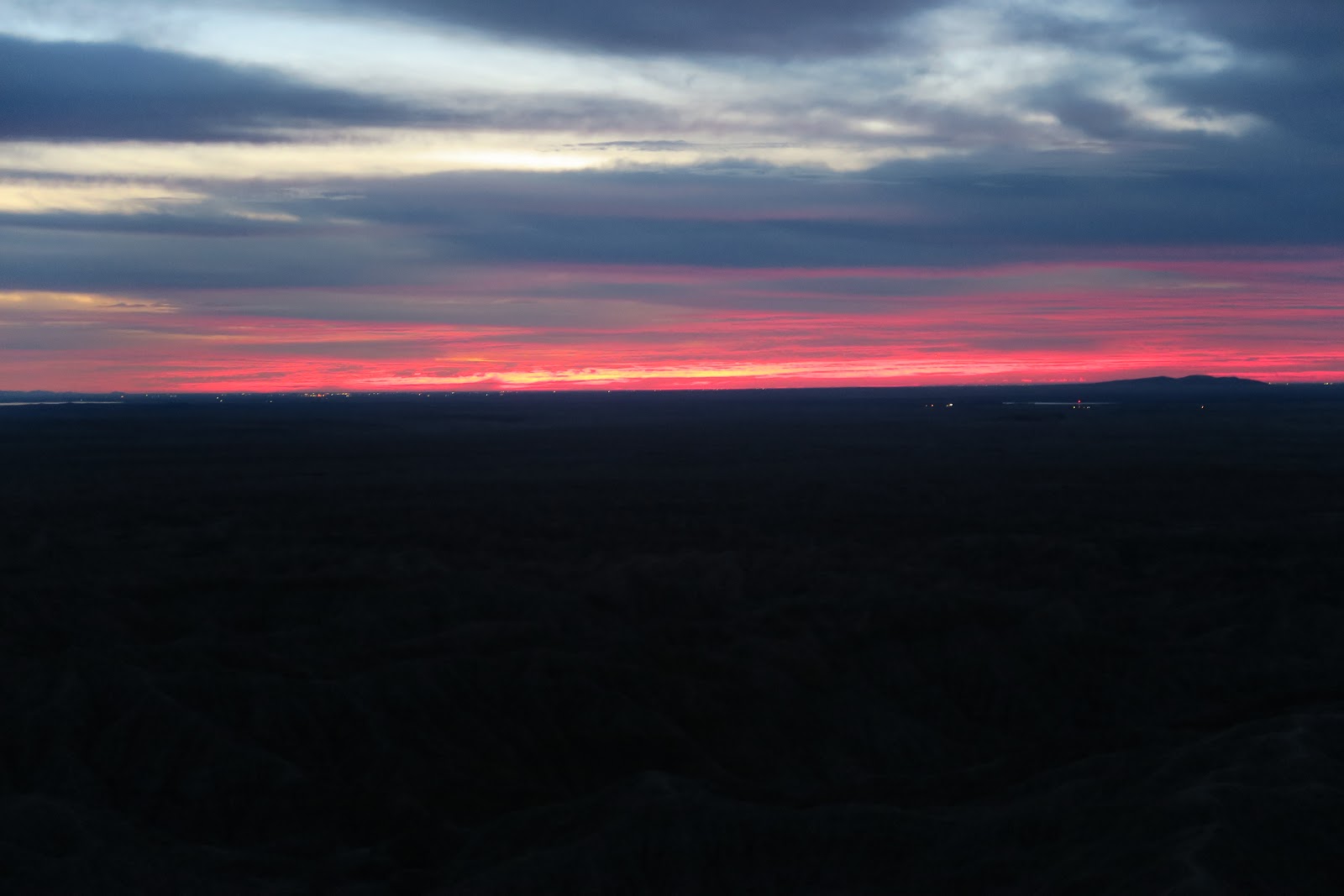
Day2: we got up around 3 a.m. to go to see sunrise at Fonts Point. First, we drove to the point where the dirt road starts. Dirt road to the Fonts Point is 4 miles. 4WD can drive, but it is too sandy for 2WD. We walked the dirt road in the dark. Then we arrived the Fonts Point 1 hour before sunrise. We boiled water and had a cup of coffee while waiting. I took some pictures with long exposure. There were stars and in the distance a little bit of light from small airport can be seen. Then sun was coming. The horizon got firing red as you can see in the left picture. It was really nice to see every moment's change in the golden spot. Nobody else around! Not many people wake up for sunrise. It was cloudy, and I admit it was not the perfect day, but still it was nice to see the sunrise there. Fonts Point is known for a great spot for sunrise and sunset. Due to thousands of small hills, the lightning dramatically changes when light source is setting or rising. 
Sun came out
After a while, sun came out from the clouds. Now hills were visible by eyes. It was really pretty. After we enjoyed the solitude, 1 car arrived (2 humans and a dog). Now time to walk the ridge of Fonts Point. 
Fonts Point: beautiful lightning
Every angle was pretty: I understood why Fonts Point is famous. The morning light was beautiful hitting the hills. And nobody else around---total solitude. I heard that sunset is also pretty, but I am sure solitude is not granted.
 After sunrise we walked the side edge of Fonts Point: it was really nice. Then we walked back to the car and had lunch at picnic table near the Tamarisk Grove Campground, which is different campground we stayed.

Then we did some nature walk in the
afternoon. First, cactus walk with signage. This was Cactus Loop Trail (1
mile). It is always nice to learn about cactus, isn't it? Then we did Yaqui Well Nature trail (1.6 mile). We somehow got off-trail, so it ended up like 2.5 mile. Good thing was we saw flower in the cactus while we were off-trail. So it was worth it. Another hiker also got off-trail and actually she was happy to see the flowers as well! Then we did William Kenyon Over look trail (1 mile). These are all near the Tamarisk Grove Campground. Then finally Panoramic Overlook trail (1 mile) from our campground (Borrego Palm Canyon Campground). Total around 15 mile hike from pre-dawn to dusk. I believe that we are qualified as real Borrego explorers.

Mine
Then next day was the final day in the Anza Borrego. This day we went to the south region of Anza Borrego State Park. First we went to Carrizo Badlands Overlook. Then we hiked up to the Mine Peak. This peak is off-trail and it was fun. Harder than expected, meaning had fun. The left picture is the abandoned mine and the peak behind was our destination. This area is much more remote compared to Palm Canyon Campground area. And I actually loved this quiet area a lot.

From Mine Peak
The view from the top of mine peak was amazing. It was big vast scenery. Nobody in the visible distance. It was quiet. Although it was December, sun in the desert made it warm enough to sit down and relax for lunch break. With 4WD in the deep dirt road has guarantee for solitude, but there is solitude without it for sure, since Anza Borrego is really big area. Then finally we did Borrego palm Canyon Nature trail (3 mile) to conclude the Anza Borrego visit. 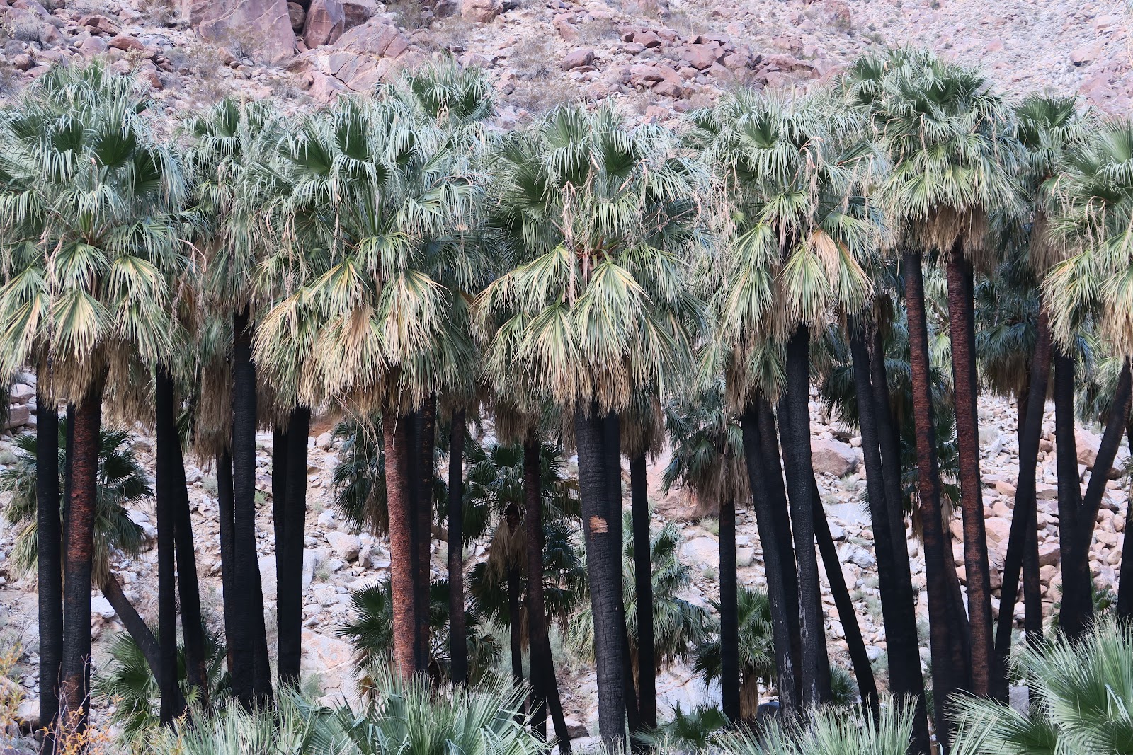
Palm
As the trail name indicates, there are palm trees at the end. You might notice that tree trunk were black. It was burnt several years ago (a hiker or child caused it) and all leaves were gone. Now leaves are back!
Overall, we enjoyed a lot Anza Borrego.
|
| Before sunrise |
|
| Sun coming |
|
| Sun came out |
|
| Fonts Point: beautiful lightning |
Every angle was pretty: I understood why Fonts Point is famous. The morning light was beautiful hitting the hills. And nobody else around---total solitude. I heard that sunset is also pretty, but I am sure solitude is not granted.
Then we did some nature walk in the
afternoon. First, cactus walk with signage. This was Cactus Loop Trail (1
mile). It is always nice to learn about cactus, isn't it? Then we did Yaqui Well Nature trail (1.6 mile). We somehow got off-trail, so it ended up like 2.5 mile. Good thing was we saw flower in the cactus while we were off-trail. So it was worth it. Another hiker also got off-trail and actually she was happy to see the flowers as well!
|
| Mine |
|
| From Mine Peak |
Then finally we did Borrego palm Canyon Nature trail (3 mile) to conclude the Anza Borrego visit.
As the trail name indicates, there are palm trees at the end. You might notice that tree trunk were black. It was burnt several years ago (a hiker or child caused it) and all leaves were gone. Now leaves are back!
|
| Palm |
As the trail name indicates, there are palm trees at the end. You might notice that tree trunk were black. It was burnt several years ago (a hiker or child caused it) and all leaves were gone. Now leaves are back!
Overall, we enjoyed a lot Anza Borrego.