2023-11-25
The Last Season by Eric Blehm
This is a book of 335 pages written in English, which is not my favorite language. I don't usually turn the page of English book with excitement wanting to know the next. Most of the time, I don't finish English book more than 100 pages. This book was an exception. I finish chore of the day and ran to this book every night.
I don't tell the detail since I want individual to read and find out, but I recommend this, especially if you are a hiker.
2023-10-14
Presidential Traverse in a single day
One of the most scenic and intense hikes in New Hampshire is known as "Presidential Traverse" It is called that way since it goes through peaks of Presidential range. It is 22 miles with 8891 feet elevation gain. This covers Mt. Madison, Mt.Adams, Mt.Jefferson, Mt.Clay, Mt.Washington, Mt.Monroe, Mt.Franklin, Mt.Eisenhower, Mt.Pierce, Mt.Jackson. (Jackson is optional). Nearly entire route is rocky as East Coast standard. The terrain makes the journey slow down. It took me almost 15 hours including 1.5 hour break.
First, I left the Boston area 2 a.m., then drove 3.5 hours. I started hiking at 6 a.m. Traditionally the starting point is Appalachia trailhead, and go south bound. The reason is because in this way the hardest part is the first half. First 3.7 mile is Valley Way trail and climbs up 3600 feet. There is a hut at the junction (Madison Spring hut). The hut provides potable water for hikers. This is great. The only spur of the Presidential Traverse is from here to Mt.Madison. 0.5 mile to the summit, so 1 mile spur. I summited Mt.Madison at 8:17 a.m. After I came back from Mt.Madison, I ate a rice ball at the hut and refilled my bottle with water. Then I headed for Mt.Adams. This is the most rocky area of the hike and usually you follow small paint on the rock. I missed somehow the paint and I went to Mt.Quincy Adams (this is not included in Presidential range). This is just a small mountain on the way to Mt.Adams. I used my extra energy. I went back to the trail and summited Mt.Adams at 9:41 a.m. Another 2 miles, I summited Mt.Jefferson at 11:12 a.m. I was getting tired and got slowed down. Another 1.5 mile, I summited Mt.Clay at 12:20 a.m. Another 1.5 mile, I summited Mt.Washington at 1:25 p.m. Because there is an auto road to Mt.Washington summit, there were tons of people there. There is a food court but it was crowded like Walmart. I didn't want to stay there, so I didn't take a break and continued. Hiking down 1.5 miles, I reached Lake of the Clouds hut. I was able to take a break in not so many clouds there. From here I stopped recording what time I summited each mountain. Too tired to record.
Then I summited Mt.Monroe, Franklin, Eisenhower, and Pierce. At the Mt.Pierce, there was a choice to go back straight to the trailhead, or detour to add Mt.Jackson. I got my second wind and decided to add Jackson. Around 9 p.m., finally I finished! I got a crown!
To celebrate I ate at Burger King at 10:30 p.m. and got chocolate shake. Finally went back home around midnight. It was a long day. By doing this, I beat my record. Now my personal record of elevation gain in 1 day is 8881 feet. (It was Mt.Shasta with around 7700 feet).
 |
| Mount Washington from Mount Monroe |
2023-09-23
Sahale Glacier Backpacking in North Cascades National Park, Washington
North Cascades National Park. For a long time it had been on my list. Despite I wanted to visit, I didn't study the trail for this trip at all. The reason was, we originally planned to backpack in the other region (Spider Gap). Unfortunately the road to the Spider Gap was closed, so we spontaneously went to North Cascades National Park.
To backpack there, permits are required. We just showed up at 2 p.m. at the wilderness center and asked if there is available permit on the day. The only permit available on that day was Basin Creek camp. Without knowing much, we said, "Sure"
The ranger was a little worried, because it will be 2000 feet elevation gain and 2000 feet elevation loss and we still had to drive to the trailhead. We said it would be fine. The ranger was from Mass, so she got excited when she found out we came from Mass.
 |
| View from Cascade Pass |
The first three miles from trailhead is switchbacks in the woods. Those switchbacks are really gentle. I felt like flat. If it was in New England, you would have to straight up in 1 mile instead of 3 miles. Once we got out of the woods, it has open vista. Extremely beautiful. With short distance, we already reached Cascade pass. Completed the uphill of the day. The view was gorgeous. Then we hiked down into the valley.
 |
| Porcupine |
The highlight of the downhill part was a porcupine. Evening is the golden time for wildlife sighting. Not only because it is their activity time, but also they sometimes come out on the trail since man-made trail is so much easier to walk for wildlife as well. When I turned the curvy part of the trail, a porcupine was on the trail. "Oh" I stopped a couple of meters away from him. He was also, "Oh" and stopped. We stared at each other for a while. I tool pictures. Then he thought, "OK. I need to go off trail" and went off in the woods. I love wildlife sighting. It is precious. After 3 miles, we settled down to the Basin Creek Camp. It is designated campsites with 3 spots. Cooking area is common and bear locker is there. This is nice because we didn't need to carry a bear canister. I don't like to be forced to talk with other campers in the common area. I know that a lot of people like "chat, chat, chat" with hikers but I am an introvert and hiking is the time to be away from chatting with human beings (probably I am minority though in that sense). There are another party of 3 guys from Seattle were at the cooking area. I let Mr.N to interact with them.
 |
| Beautiful Basin |
The next day, we traced back to the trailhead, but we did two side trips. The first one was short to the small basin. It was worth it. Countless falls could be seen coming into the basin. Nobody was there and really peaceful.
The second side trip was a big one. First we went back to Cascade Pass, which required 2000 feet elevation gain, then from there, 2.3 miles with 2300 feet elevation gain of side trip to see Sahale Glacier. To go to Sahale Glacier is a popular dayhike, so there were many people on the trail. I wouldn't say it was peaceful trail, but, BUT, the view was incredible. Probably one of the best views I've had. No wonder how popular the hike is. The trail is a lot of scree portion and I wished I had not carried the big pack. I got tired with total of 5000 feet elevation gain of the day. The glacier was amazing, and the all surrounding mountain scenery was FANTASTIC! We took a long break to soak into the view. WOW. I wanted to stay longer, but it was past 4 p.m., so we started descending. Going down was easier with admiring views every step. There are many mountain goats with babies. Cute! After Cascade Pass, switchbacks were endless, but we came back to the parking lot. We saw a black bear on the road near the trailhead.
 |
| WOW |
What a view-packed 2 days!
2023-09-03
Goat Rocks Wilderness (Cispus Basin-Cispus Pass, Old Snowy Mountain, Goat Lake, Hawkeye Point), Washington
Following backpacking Three Sisters loop in Oregon, we drove to Washington and backpacked in the Goat Rocks Wilderness.
Due to some trail closure in the Northern part of trails in Goat Rocks Wilderness, we had to drive to the different trailhead from the one we had planned. We drove a quite bit, so we couldn't start hiking until 4 p.m. Despite the late start, thanks to a long daylight, we were able to make it to Cispus Basin by 7 p.m. It was 6 miles with 1500 feet elevation gain. The first part was in the forest, but once we got out of the treeline, it was surprisingly beautiful. Cispus Basin is DEFINITELY one of the most beautiful places I have hiked in. When I turned the trail and the entire Cispus Basin entered into my vision all of sudden, I was wowed. The picture below is the first sight of Cispus Basin. I thought, "How could so beautiful place exist?" We camped at the basin. It was an awesome spot to spend a night. It was super great, not only due to the scenery but also because nobody else was there. Compared to Three Sisters loop in Oregon, which was over 80F (27C), Cispus Basin was very cold.
 |
| Cispus Basin |
Next morning, we did some day hike without big packs. From Cispus Basin to Cispus Pass is only a mile. Generally I love going up to a pass, because I can see the other side of mountain and whole new valley view.
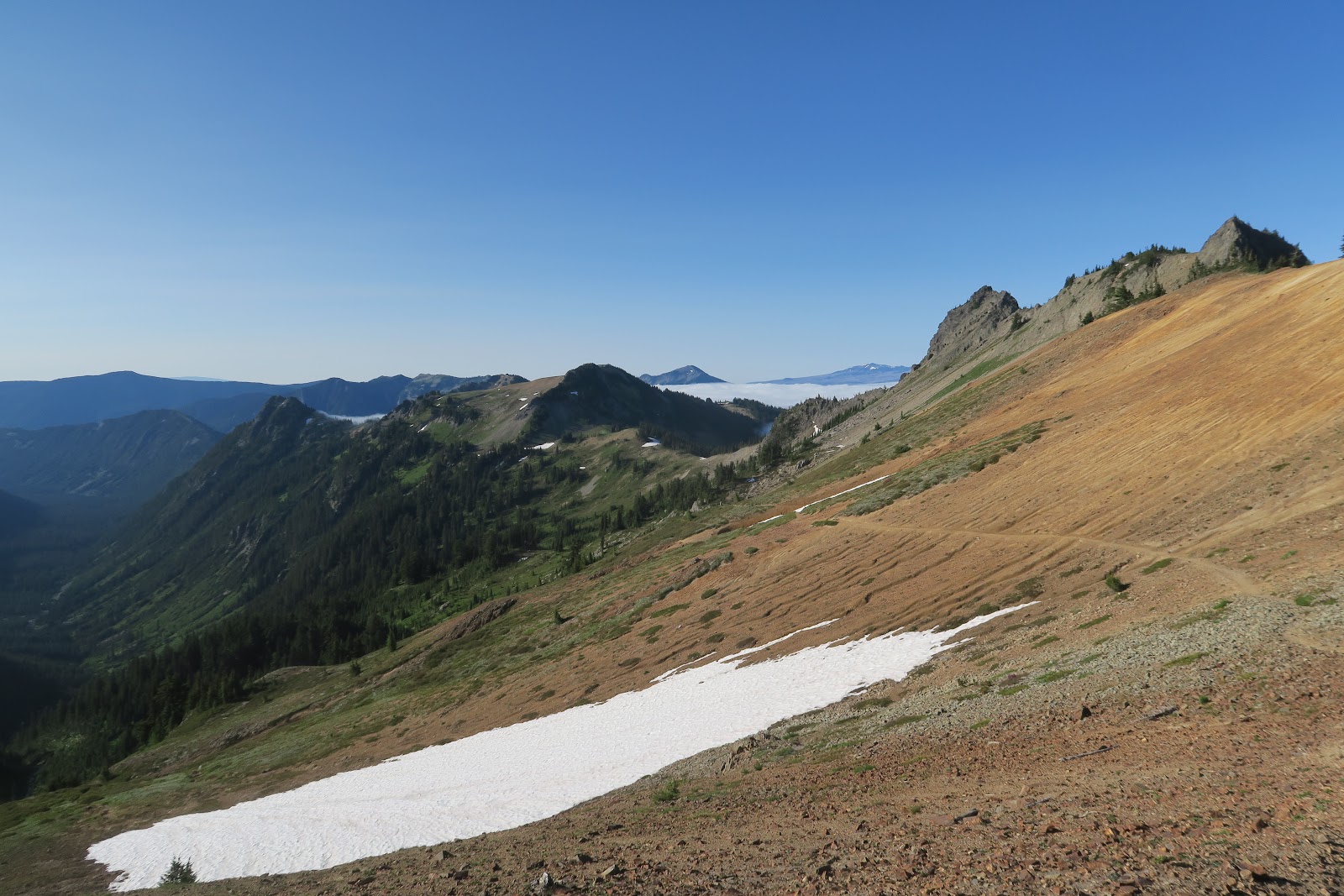 |
| Cispus Pass |
This time was not an exception. The other side has an amazing view, too. In the distance, there was sea of clouds. This is PCT and I read somewhere online this portion of PCT is the highlight of Washington section. Even this is one of the highlights of the entire PCT. We saw only two PCT hikers going south. North bound PCTers were not yet in Washington in July.
 |
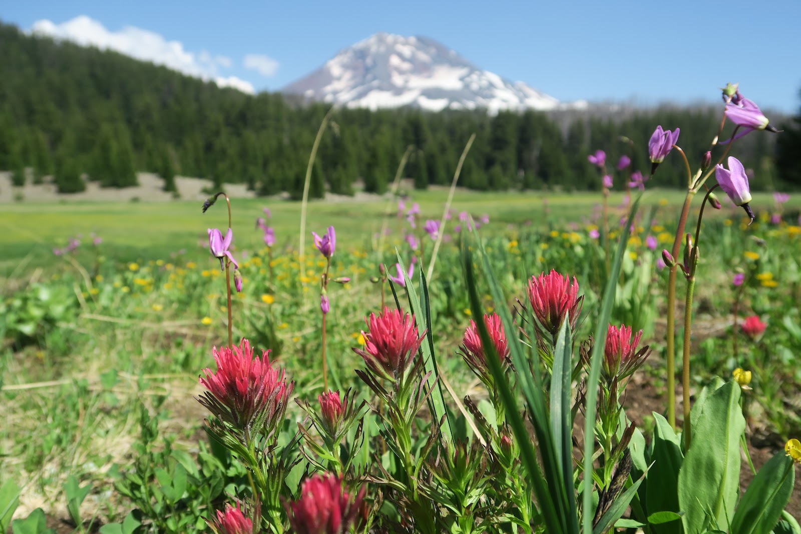
| Mount Adams |
 |
| Basalt |
 |
| Cispus Pass |
 |
| Another basin |
 |
| Going to Old Snowy |
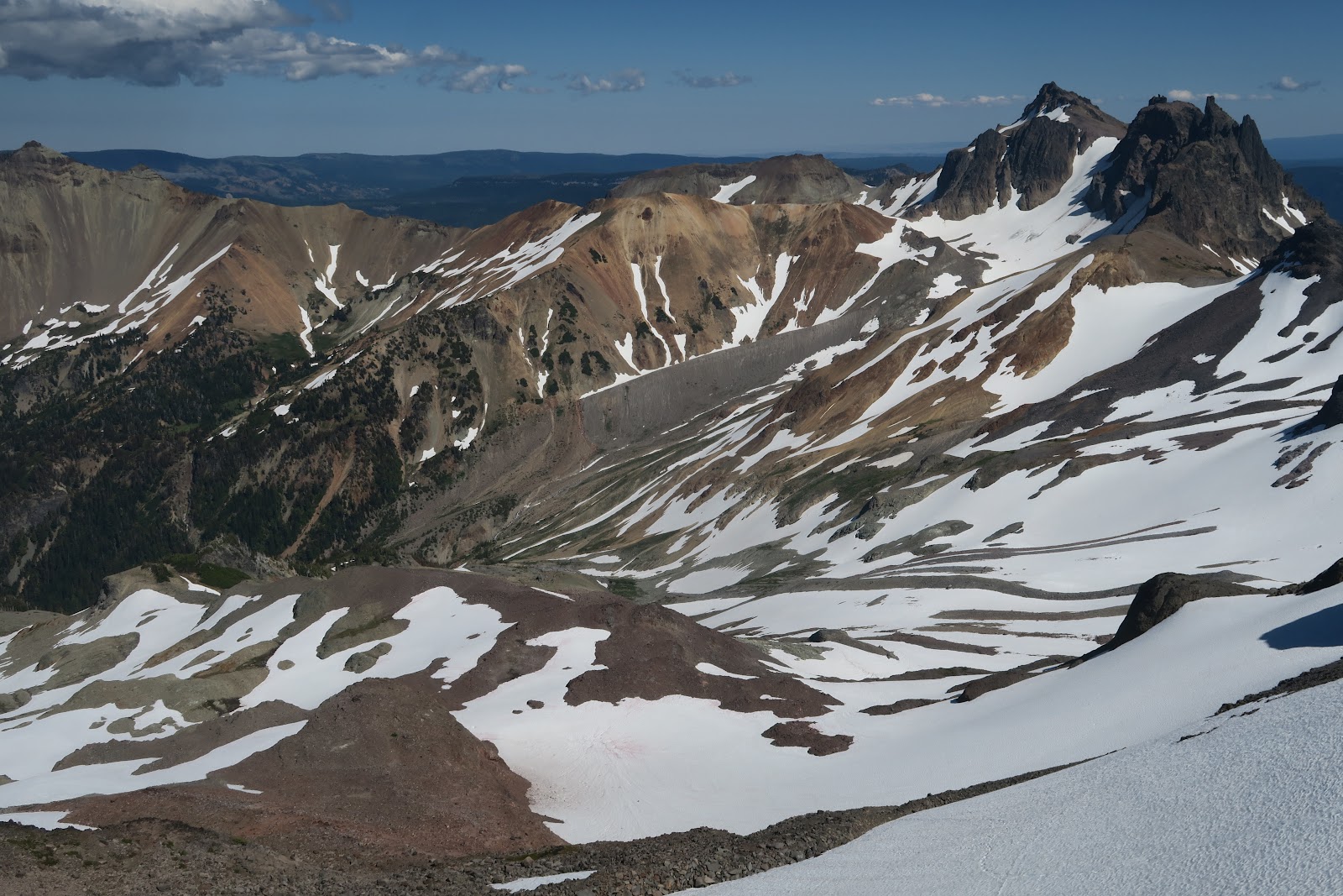
The side trail to Old Snowy Mountain is not an official trail, but there is very clear used trail. The view is....fantastic! 360 view. One direction, you can see Mount Rainier. Luckily no clouds covered it. You see surrounding beautiful mountains all over the area. As the name indicates, a lot of snow remains and it makes the scenery even more magnificent.
 |
| At Old Snowy |
 |
| At Old Snowy |
 |
| mountain goat |
 |
| Goat Lake |
Next day, our plan was to hike out, but we did a small side trip to Hawkeye Point. Ah again wonderful view. Mountains surrounding and Rainier in the distance. Perfect weather and temperature. Goat Rocks wilderness rocks. We were the first person who reached the Hawkeye point of the day. At the top two of us and other 2 people only. We took time to enjoy this special view. By the time we descend to the side trip junction, we saw 5+ people going up there. There was a party with kids, and the parent asked us how the view was. We said amazing. They asked if the Rainier could be seen and we said yes. Then the father told the kids that they would see that. Kids were sitting on the trail in aloof. Typical funny scene.
 |
| From Hawkeye Point |
I fell in love with Goat Rocks Wilderness. So beautiful. I'm grateful that I was able to hike there.
2023-08-13
Three Sisters Loop, Oregon
Once again summer vacation came!
We started 2023 summer with Three Sisters Loop in Oregon.

Three Sisters Loop is in the Three Sisters Wilderness in Oregon. It is called that way because there are three distinct massive mountains lines together: North Sister (10094'), Middle Sister (10053') and South Sister (10358). Some mountains around the three sisters have names related to family. The Husband (7524'), the Wife (7054'), Little Brother (7810'), and Mount Bachelor (9068'). During the three sisters loop hike, you can see all of the family. The loop was about 63 miles total (including 2 side trips we did).
Permit is required for the corresponding trailhead you start. Also pass to park at the trailhead is required.
Let's begin the journal day by day.
Day1: Pole Creek Trailhead to Collier Cone base
The loop itself doesn't have any direct trailhead. You need to hike in outside of the loop. The closest to the trail of the loop is Pole Creek trailhead. 1.4 mile approach to the loop. The most popular trailhead is Obsidian trailhead, which is 4.1 mile to the loop. The reason why people like Obsidian trailhead is no need to drive dirt road. To reach Pole Creek trailhead, there is 20 minutes' dirt road drive, but that is very well maintained smooth road: no problem with sedan. I already knew that the Pole Creek area was burned due to Pole Creek Fire in 2012, but the damage was much bigger than I thought. It was already vast burned area during the drive to the trailhead, although low height plants were abundant and mother deer and two fawn were seen: the sign of recovery. After 11 years, still the burn was massive and it looked to me that another five decades needed to recover. There were only 3-4 cars at the trailhead. We excitedly started the adventure and hiked easy 1.4 mile to reach the loop. The 1.4 mile was maintained well and there was no single deadfall. Once you reached the loop, we found a lot of, really a looooooooot of fallen trees on the trail. We lost trail many times, because there were too many dead trees and trail was not clear at all. Since there was no live trees under 90 degree F, and strong sunshine without shade, it was quite hot. This Pole Creek Fire burned area continued 9 miles. I need to admit that this was not really a pleasant hike. The picture below gives you an idea how it looks like after 11 years of Pole Creek Fire.
 |
| South Sister in the Pole Creek Fire Area |
Due to the fire, actually I could say that the view is better. You can see South Sister through the burned forest. Before the fire, I'm sure it was rather monotonous view of forest. On the first day, we only saw 6 hikers. One party had 4 backpackers with dogs. The other party of two. That's it. After 9 miles, finally the Pole Creek Fire area was over, and we entered the interesting area. The first thing we saw was lava.
 | ||
Lava with snow
|

All sisters are volcano, and lava is everywhere. It is really an interesting area. Once the Pole Creek Fire are is over, the landscape dramatically changed. I am certain that I had never seen that such a lot of lava stays with massive snow. Black lava looked really hot at 90F, but with snow. It was a little eerie, but cool scene. Soon after walking between lab, we passed by Collier Cone. After around 12 miles, we found a sweet spot with small stream from snow melt and called it a first day. It is the (live) trees, but on the small hills and there is a nice view of North and Middle Sisters and Little Brother. There are mosquitoes but with mosquito net in the head, and mosquito pants and jacket, it was manageable for me. As usual, without any protection, Mr.N didn't get any bites (he claimed two bites, but I didn't see any swelling on the skin and they were not itchy. Every single bite of mine has huge swelling and it is extremely itchy for days).
Day2: Collier Cone base - side trip to summit Collier Cone-south of Linton Meadow
On the 2nd day we started with a side trip to the Collier Cone. Actually we didn't plan to go all the way to the top, but it looked easy so I continued to the top and Mr.N followed. Going up the ridge and first sight I saw was like this.
 |
| North and Middle Sisters and Little Brother |
WOW!
From left, North Sister, Middle sister in the middle, and Little brother in the right. This is the Collier Glacier viewpoint. Obviously a lot of glacier is melt and now have some glacier lakes and moraine on the slope of Little Brother....but still an amazing view.
 |
| Going to Collier Cone |
It is really hard to leave just checking out the viewpoint, we continued walking on the ridge toward North Sister, which is the way to go to the top of Collier Cone. In the picture left is the walk to the Collier Cone summit. From Mr.N's size, you can tell how massive the landscape is.
 |
| Closer look of North Sister |
 |
| From Collier Cone |
 |
| Obsidian |
 |
| Linton Meadow |
 |
| Open view |
Between meadows are more volcanic terrain as you can see in the left picture. On the 2nd day, almost non-stopping view of sisters either from meadows or from dry fields. What a treat! We set a camp a little after Linton Meadow on that day.
Day3: South of Linton Meadow to Moraine Lake
 3rd day was another pretty day. Again, it was view packed. Mesa Creek area had full of colorful flowers. This would be a nice place to camp and spend evening there, but it was like 9 a.m. we were there.
 We had snack along the stream. It was a sunny spot. I went behind tree area for the restroom break. Ugh! I got surrounded by 100 mosquitoes immediately, but I had to do my business... such a pain especially for female bathroom break.
 |
| The Wife and The Husband |
 |
| Wickiup Plain |
 |
| Moraine Lake with Broken Top |
 |
| Moraine Lake with South Sister |
Indeed. The proof is the left two pictures. Above picture has Broken Top view and the below picture has South sister view. Awesome campsite. This is my favorite campsite during the loop. We set up the camp, went down to the beach of the lake and I soaked my legs. Mr.N swam.
We had a very relaxed afternoon.
Day4: Hike to South Sister, then go to Green Lakes
 |
| Moraine Lake and Broken Top |
 |
| On the way up |
 |
| summit area |
 |
| At the South Sister top |
We came back to our camp around 1 pm and we packed up and hike to the Green Lakes. It is again a very pretty area. The most stunning view I remember the most is the next morning's South Sister reflection on Green Lake.
 |
| Green Lake |
Day5: Green Lakes to Pole Creek Trailhead
 |
| Dead falls |
The last day was hiking out. After we enjoyed calf beautiful Green lake in the early morning, hiked some open meadows and forest, then did a small side trip to Golden Lake which has a perfect Broken Top view. After Park Meadow, we came back to the area of Pole Creek Fire. Again, hundreds of dead falls. Imagine trail is like left picture for 3 miles. You need to climb over and it slowed one down. Indeed, two people we met Green Lake area, they started at Pole Creek trailhead and their original plan was camp at Green Lake and go back to Pole Creek trailhead. Due to such tedious trail, they said they would hike out south of Green Lake, and try to hitch back to Pole Creek trailhead. They said that we were brave to do whole loop with such trail. We also met a couple with a toddler near the Pole Creek Trail junction where the dead falls were not yet started. They were ambitious: plan to a whole loop with a toddler as eight figure (half way they would resupply). It would be a lot of work ahead for them. I bet they stopped first half of 8 figure.
Overall, I enjoyed an amazing mountain view, interesting volcanic geology, colorful flowers. Loved the three sisters. I someday come back to scramble up to the Middle Sister!
2023-02-20
Watching Manatees, Florida
2022 winter break, we went to Florida. The main purpose is to see manatees!
I had not known about manatees until several years ago when I first went to Florida. During that trip, I only saw 2 manatees once. I wanted to see manatees again. So this time we drove to Florida.
Manatees are mammals living in the ocean. They are "sea elephants". Their closest animal is indeed elephants. They are out in the sea in the warm season, but in the winter, they get frostbite in the far out ocean. Therefore they come near the springs in Florida. Springs are the same warm temperature all over the year, so those are the safe place to spend winter for them.
First, we camped at Blue Spring State Park. Blue springs are crystal clear and very beautiful green colored water. The rangers there counts manatees everyday. For my surprise, the day we were there, about 620 manatees were there! Can you believe that? I had never seen so many sea mammals in one sight.
 |
| manatees! |
 |
| more manatees |
We kayaked in Tarpon Hole. Here, we were able to kayak, and even snorkel! Snorkeling was really cold, but we had an unforgettable experience. Seeing a manatee in the ocean. So cute. Very big. Bigger than I had expected. The shape is like a baked potato. It swam by me peacefully. What a wonderful moment to be there. 10+ more people were around snorkeling there, but we were the only people WITHOUT water suits. Because other people were from a guided tour, so they were provided with swim suits, and when then left, the guide was telling them that hot drinks were waiting on the boat. Well, we had insulated mug filled with coffee. Although it was Florida, the cold storm hit all U.S., and it got cold even in Florida. Next time I will definitely bring water suits.
 |
| MANATEE!!! |
 |
| manatee |

2023-01-20
Island Lake Backpacking, Uintas, Utah
This is the very last overnight backpacking in our 2022 summer trip. In Idaho, we completed all the backpackings ahead of schedule. It was good because wildfire grew. We escaped from smoke and drove to Uintas wilderness in Utah. We did a fantastic 2 nighter including Kings Peak, which is Utah's highest point. Then we still had 2 days left. Kings Peak loop is the most famous backpacking in Uintass, and we didn't have an idea what else would be good. I looked at Uintas map and decided to give it a try to go to Island Lake. Overall, I liked it, but I admit that not as dramatic scenery as King's Loop one. However, it is still memorable and nice.
As I mentioned it was not popular, there was no pure backpackers on the way, however, we saw 3 people in a group and solo person for hunting. It was a hunting season in mid-September. One guy said that it is unusual to see a non-hunter person in the area. From trailhead to Island lake was in the forest. Once we reached the Island lake, the trail got faint and we had a little hard time to find a clue of old trail. The usage of trail in that area is very low. We set up a camp, and we hiked up to the pass over the Island lake. The view from basin on the other side of Island lake was really marvelous. Iconic color of Uintas' rock color and vast basin was quite a scene to be. We enjoyed the view with warm evening light shining up the basin.
 |
| Great view |
On the next day we got up early and had the last breakfast of the trip. It was really quiet morning. I saw an elk sprinted along the Island Lake. Maybe he had a sip from lake. The inlet of the lake was near our campsite was the best water I had ever. It was refreshing, cold, clear, pure, and tasty. We talked about our friend Mr.S1 who likes good water: he would be jealous.
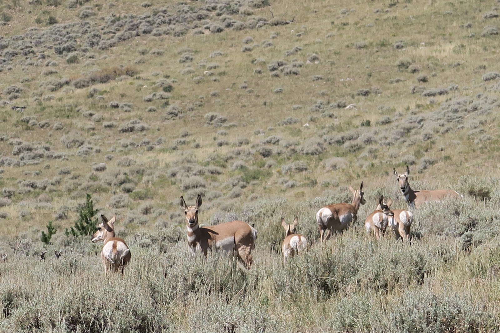 |
| Antelope |
Lastly we had bonus. Antelope. I saw antelope in Wyoming in the past. It was first time seeing in Utah. They are always cute and gave us great gift as a finale of this trip.
2023-01-07
King's Peak Backpacking, Uintas, Utah
I fell in love with Uintas Wilderness.
I had never heard of Uintas Wilderness in Utah, but 2022 summer I had an opportunity to backpack there for four days. If you are a (hardcore) reader of my blog, you might think that we were backpacking in Idaho in 2022 summer. Yes, you are correct. The reason we headed for Utah for the last four days was that the wildfire that started during our Idaho hiking was getting severe. Another reason was that all the itinerary we planned in Idaho was finished ahead of schedule. Due to those reasons, we decided to go somewhere else free of wildfires. We anyway had to go to Utah to fly back to Boston, we searched trails in Utah area, preferably near Salt Lake City where we were going to fly. Uintas Wilderness caught my eye and suggested to Mr.N. There is the highest point of Utah in the wilderness and he liked the "highest in Utah" phrase. Then within an hour of finding it, we already on the road. The first one hour of Idaho section was really really smokey. It was kind of yellow world, because sunlight came through thick smoke in the sky. After an hour and half, we got out of the smoke and it was clear.
We camped at the campground at the China Meadow trailhead. It was past Labor day, so it was free!
The first day we hiked around 10 miles. All the way was really pretty. I really enjoyed meadow and mountain scenery. One of the spots we took a bread was like this below picture.
 |
| What a view |
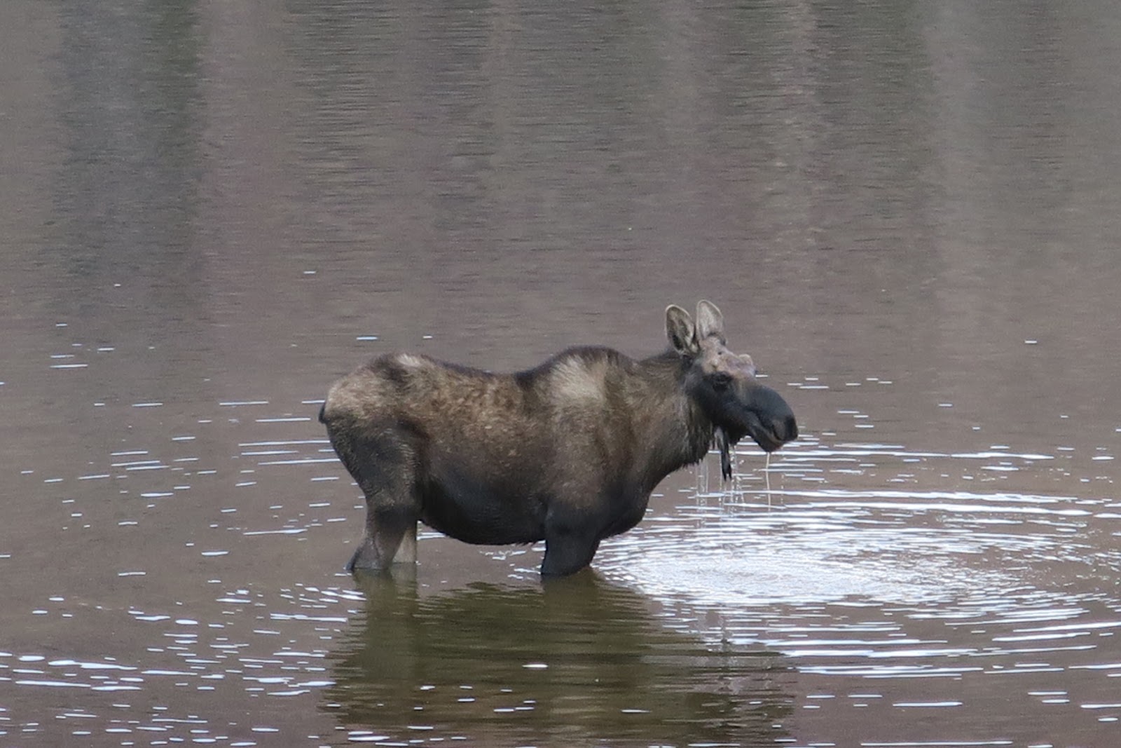
 |
| 3 moose |
Colors of mountains are quite different from Idaho. Each has unique beauty and enjoyed the varieties of places. We continued hiking on the meadow toward the first pass. Our plan was camping the first night somewhere not too close to the pass so that we could hike up the pass in the early morning. When we reached Henry's Fork Lake, the time was a little early like 4 p.m. for concluding a day. We usually hike until 5 or 6, sometimes until 7 p.m. However, we got a reason to stop. Many moose in the lake!!!!! In the left picture you can see three moose. On the grass across the lake is a mother and a child. One moose I was able to see a good picture by standing not too far.
 |
| eating a lot |
We set up a camp and observed moose. It was precious time. After we enjoyed seeing therm, we saw a couple of backpackers came from opposite way we were hiking. They shouted and and talked super loud at the lake (yahoo). The moose were scared and they ran away. Especially mother and a calf were cautious and they had to swim.
 |
| Swimming hard |
The baby was not yet able to swim as fast as adult, so she had a little hard time catching up her mother (left picture).
Not good to be such loud in wild, especially near the wildlife!!!
I was sad to see them gone, but after we had dinner and tea, they came back including the mother and baby. They drank water from lake and I was happy again too.
 |
| From Kings Peak |
 |
| Kings Peak sign |
The only group we saw on that day was at the King's Peak. They were doing a very long (~14 hours) day hike from a different trail we started. They are from Salt Lake City and they had to drive back on that day: loooong day for them. They, 4 guys were very fast: they called each wife at the top since there was cell reception (often very high peak has cell phone signal). It was funny that we learn the "normal world's news" at top of Utah: one of their wives said Queen Elizabeth passed away. We overheard it and Mr.N asked if it was true. The other guy said, "Yeah his wife is reliable, so seems true LOL", then other guy said, "Finally Charles is king and now anytime he could die at his age", interesting and unique memory for us.

Other side of Kings Peak

Lake and Kings Peak
Then we came down to the basin. The basin was incredible. The above picture, the highest point you see on the right is Kings Peak. The rock color has golden yellow, brown, red, dark brown. The lightning is dramatic. With combination of clouds, the scene is the beauty of a moment. This scene was so strong and I felt like the beauty went through my heart, as knife pierce directly to my center of heart. We hiked through this vast basin to the next pass. The entire basin was only us. (those 4 guys went down to the other side). As we walked, there were some small lakes on the basin. It was quite pretty. 
2nd campsite
We again hiked up to the pass and went down to the lake and camped there.
After the pass, the rock color is really red and the region is called Red Castle. On the third day we hiked around Red Castle. The main Red Castle area is a perfect distance for overnighter, and it happened to be weekend, so we saw a lot of people there. I was glad we camped at the different place where nobody around. I love peace and solitude in the wilderness. 
Red Castle
Red castle is in the left picture. It explains why the area is called Red castle (good I don't need to write up). We did some cross country around red castle where there is no trail so that we enjoyed quite area with lake as you see in the picture. Overall I really loved Uintas and I'm glad we explored there.
|
| Other side of Kings Peak |
|
| Lake and Kings Peak |
|
| 2nd campsite |
After the pass, the rock color is really red and the region is called Red Castle. On the third day we hiked around Red Castle. The main Red Castle area is a perfect distance for overnighter, and it happened to be weekend, so we saw a lot of people there. I was glad we camped at the different place where nobody around. I love peace and solitude in the wilderness.
|
| Red Castle |
Subscribe to:
Posts (Atom)