Two in One hike!
Phipps Arch and Bowington Arch in a day hike. About 10 mile.
 |
Maverick Bridge
|
This hike starts along highway12. The trail goes along Escalante river, then at the split, go right to go to Phipps Arch. Walk in the Phipps wash. 0.6 mile walk in the wash, there is a side canyon to see Maverick Bridge. Topo map and Alltrail map are both wrong about Maverick bridge location marked. It is easy to tell the location is wrong if you are there, since the location is really over the cliff. It is a small bridge, but you can walk on the bridge and fun.
 |
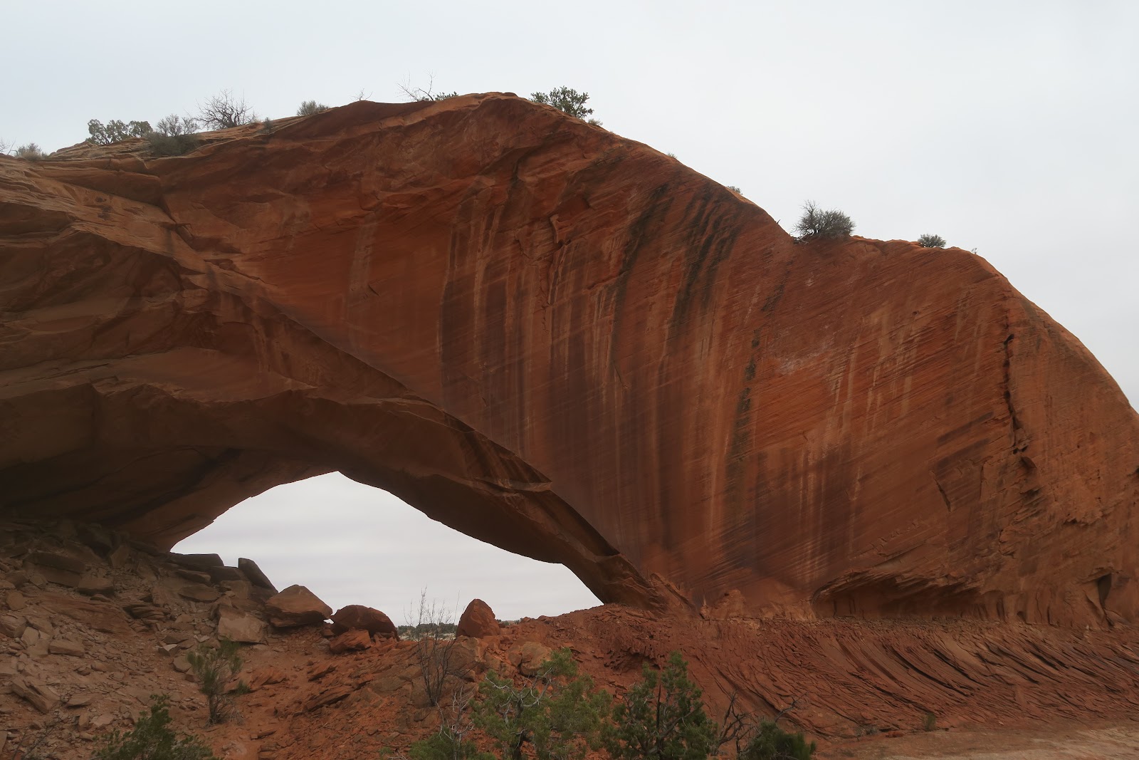
Phipps Arch
|
 |
View from the arch area
|
Then
go back to Phipps Wash and continue the walk. Since Phipps Arch is
above the canyon, one needs to go up the side rocks. The arch is not at
all seen from the bottom. The last section is scrambling. After several legs and arm
work sections, suddenly the arch vision comes in. Phipps Arch is very
impressive. It is really thick. It resides at the top of the surrounding
canyon like a king. The canyon below the arch is quite nice, too. Indeed 360 view from the arch.
 |
From other side
|
You can walk under the arch to see the arch from other side. The left picture is Phipps Arch from the other side. You might be able to see the register box under the arch in the first picture. I signed it for fun. The last person who signed was on the thanksgiving day, which was exactly one month before we did on 2023/12/22. I guess I am the last person at Phipps arch in 2023, because weather forecast was saying it would get much colder after the next day we hiked to Phipps Arch.
There are a number of round rocks around Phipps Arch as you can see in the left picture. It is interesting to see them. We enjoyed so much Phipps Arch in complete solitude. Then we headed to Bowington Arch by tracing back Phipps Wash. At the split, we went left this time to go to Bowington Arch. First, some more Escalante river trail, then Bowington Arch trail. I don't know these trail names are official, though, because Bowington arch trail is just wash.
 |
Bowington Arch
|
Bowington Arch is quite impressive, too. Arch is above the dry pour-off and it is dangerous go under the arch, but you can scramble up to just before the arch's bottom. We sat down a little further down to get the best view of arch and had a snack break. During the break, Mr.N said, "I can't find my blue hat since I was at Phipps Arch, but I did very thorough stuff check there"
For a moment, I was "....", because, THE BLUE HAT was RIGHT BEHIND HIS NECK.
We traced back to the trailhead. Although several cold Escalante river crossings, this was a great hike.
After coming back, when I write blog about hike, sometimes I again search the trail on the internet. I found that on the way to the Bowington arch, there is rock art called "43 Men Red Men Panel" Darn, we missed it, but someday I will come back.


