I am a Japanese female who came to the U.S. for the research opportunity as a scientist. In my free time, I go hiking, backpacking, XC skiing. I love to be in the deep wilderness. I write my adventures from all over the world and Introduce the beauty of nature, from a viewpoint of Japanese. 日本出身の女性研究者かつハイカー。 休日はハイキング、バックパッキング、クロスカントリスキーなどで多忙。 日本人の視点から見た世界中の自然の美しさを、読者が旅をしているような感覚で読んで頂ければと思い、このブログを作成。
2024-05-31
Fisher Towers
Another great hike not so far from Moab, but far enough to be not crowded. This is 23 mile drive from Moab, and then the last 2 miles to the trailhead is dirt road, but smooth surface. Along the way there are 5-6 BLM (Bureau of Land Management) car campgrounds. There is one at the trailhead at Fisher Towers. We camped there a day before this hike so that we could start hiking early in the morning. Now BLM got greedy and camping fee is $20 without providing anything such as water. Anyway it was convenient for hikers to do Fisher Towers. There were 3 sites, and 2 of them were occupied when we arrived there. Next site one's car was from Montana. They had a big fire with logs they brought. Mr.N (who is from Montana) said that they are not real Montanan since they had big fire, and they kept engine running during night to keep them warm (it was very cold night like 10F). I had no opinion about it and I let him say what he wanted to say.
The book I read said that Fisher Towers is more popular for rock climbers rather than hikers, but we didn't see any rock climbers or hikers during our hike. This is around 4.5 mile with 750 feet elevation change. Trail is well marked and easy to follow.
In this hike, there is more to see. The left picture is other vast field view. The sunlight was starting to hit the hills in the distance. After sun went up higher, the entire field was under the light. What a great view!
When we came back to the trailhead, one guy was about to start the hike. Yay our hike was in all complete solitude and maybe his.
2024-05-17
Shikes Canyon, Utah
Shikes Canyon is really really exciting!
I had been wanting to explore Shikes Canyon for a long time. The reason is because I hiked Kane Gulch and Grand Gulch in December 2021 and knew about Shikes canyon from the map. Shikes canyon is a tributary of Grand Gulch. Since we used Kane Gulch to enter Grand Gulch we didn't have a time to explore Shikes Canyon. Very glad to come back to the Cedar Mesa area and check Shikes Canyon out. I was especially looking forward to observing Green Mask Panel in the Shikes Canyon. It turned out that I enjoyed much more than I had expected.
The day before the hike in Shikes canyon we did a dispersed camping in BLM about 30 minutes drive away. It was a very cold morning and the car thermometer indicated at 8F (-13.3C) at the trailhead of Shikes Canyon. It was crispy air and of course no car in the parking area in such a frigid day.

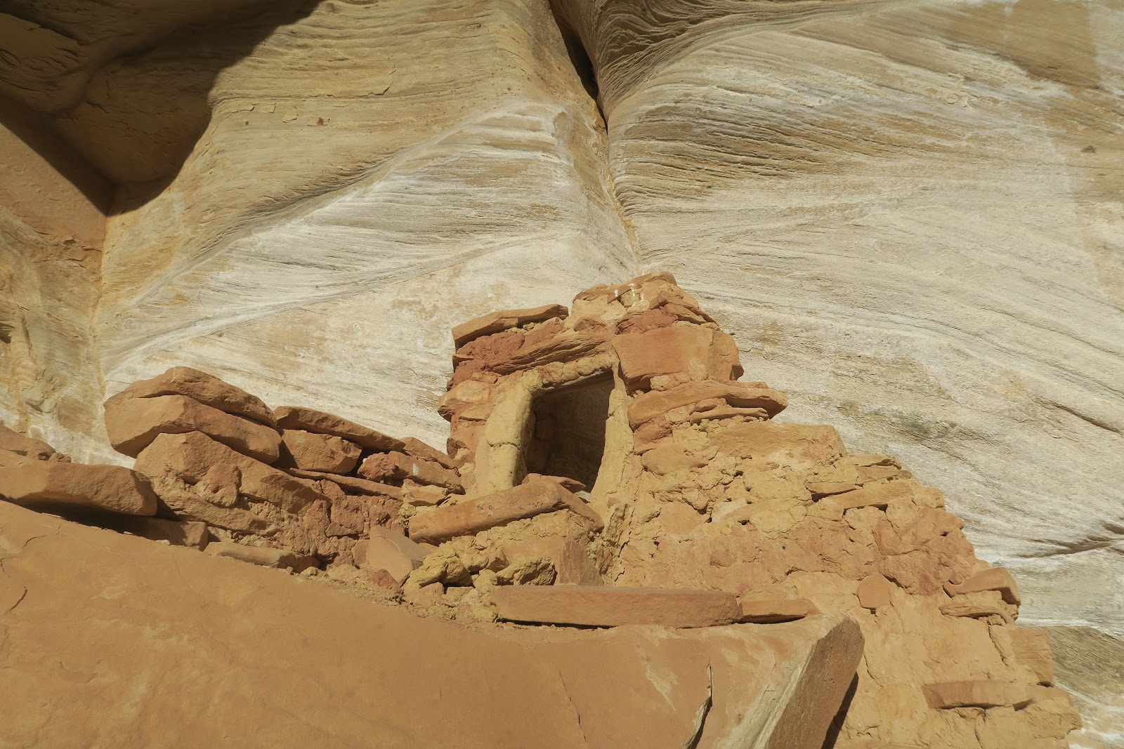
Nice building
The first attraction we found in the canyon was a neat small ruin. Nice little steps to the entrance. The inside is quite small. I wonder this was a granary or one person bedroom. If it was a bedroom, literally there is only space to lay down. Ceiling is very low. It might be hard to see, but there is a faint rock art above the ruin. It is diamond shape with white color.
Next ruin we spotted was in the distance. Actually really far away in other side of canyon. You have a very good eye if you can find it in the left picture.
I have a Canon camera that can zoom X17. The left picture is the structure I got with the camera. It is a small structure. It would take an hour to go there and seems not particularly interesting to spend so much time, so we decided to proceed. 
Nice color
The next ruin we found is nicely preserved (left picture). It is under the alcove of off-white color rock. Interestingly, the ruin's bottom part matches the color of alcove. The upper portion is made of more darker color stones.
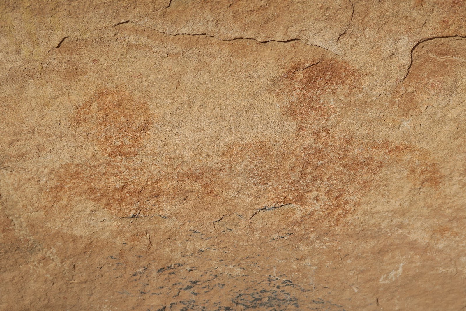
Next ruin we spotted was again in the other tributary canyon and very small, so we decided to not go there and proceed. Here some humans without head are painted. The couple (?) drawn by dots are interesting. Each person has boobs (?) with one dot (nipple?).Small person in the right with filled brown is a kid? No answer but free to imagine. The left picture is another set of humans without heads. Again one person is a little bigger than the other. I read on the internet that this picture is a C-section birth: some people believe it that way. In that theory, the bigger one is a female. Between two bigger person, there is a small person with small dot that could be a head. There are many two people drawings. This one looks like having heads. The left one is white color.
Another two people with heads. Interesting head shape. Also there are nipples (?) with another color.
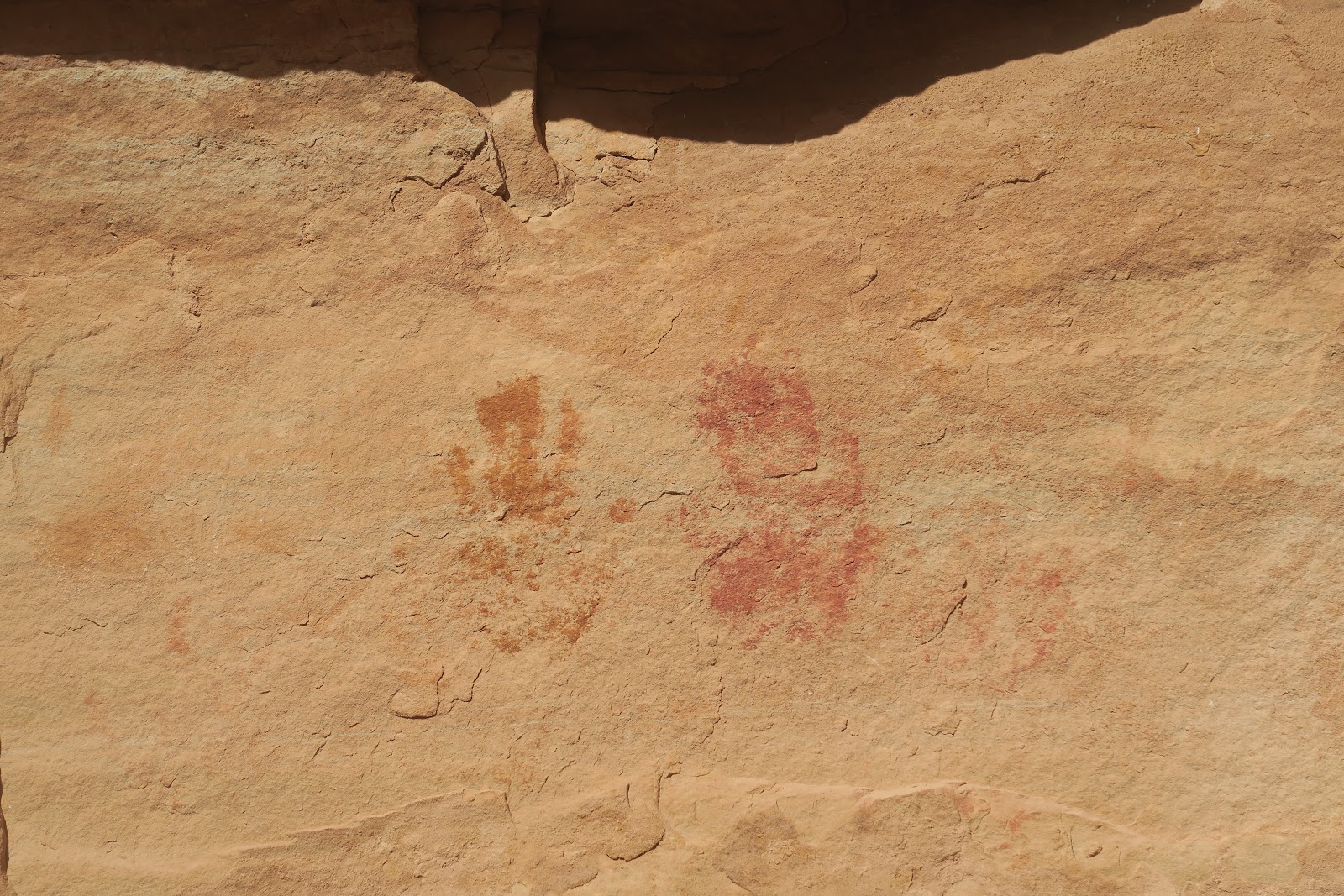
Another two people. One is bigger than the other. To me these two people are couple, but who knows?There is upper level with some ruins, but no way to reach there. I could see the pictoglyph there but not completely. The left is the best picture I could capture. Looks like the same counter-triangle shape humans without head. Color is nicely preserved. In the right you see many hand stamps. It seems relatively common in Utah.
 |
| Nice building |
The first attraction we found in the canyon was a neat small ruin. Nice little steps to the entrance. The inside is quite small. I wonder this was a granary or one person bedroom. If it was a bedroom, literally there is only space to lay down. Ceiling is very low. It might be hard to see, but there is a faint rock art above the ruin. It is diamond shape with white color.
Next ruin we spotted was in the distance. Actually really far away in other side of canyon. You have a very good eye if you can find it in the left picture.
Next ruin we spotted was in the distance. Actually really far away in other side of canyon. You have a very good eye if you can find it in the left picture.
I have a Canon camera that can zoom X17. The left picture is the structure I got with the camera. It is a small structure. It would take an hour to go there and seems not particularly interesting to spend so much time, so we decided to proceed.
 |
| Nice color |
Next ruin we spotted was again in the other tributary canyon and very small, so we decided to not go there and proceed.
Here some humans without head are painted. The couple (?) drawn by dots are interesting. Each person has boobs (?) with one dot (nipple?).
Small person in the right with filled brown is a kid? No answer but free to imagine. The left picture is another set of humans without heads. Again one person is a little bigger than the other. I read on the internet that this picture is a C-section birth: some people believe it that way. In that theory, the bigger one is a female. Between two bigger person, there is a small person with small dot that could be a head. There are many two people drawings. This one looks like having heads. The left one is white color.
Another two people with heads. Interesting head shape. Also there are nipples (?) with another color.
Another two people. One is bigger than the other.
Another two people with heads. Interesting head shape. Also there are nipples (?) with another color.
Another two people. One is bigger than the other.
To me these two people are couple, but who knows?There is upper level with some ruins, but no way to reach there. I could see the pictoglyph there but not completely. The left is the best picture I could capture. Looks like the same counter-triangle shape humans without head. Color is nicely preserved. In the right you see many hand stamps. It seems relatively common in Utah.
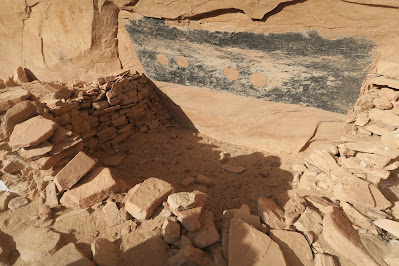
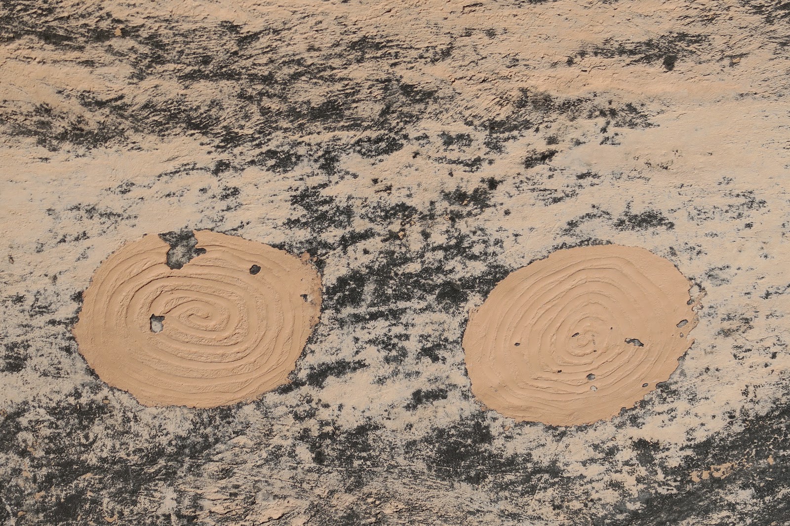
Here is an extremely interesting structure. It looks like a kiva, but not sure. The thing I had never seen was what you seen on the wall. It is painted black in rectangular shape. Then there are 4 circles painted. Zoomed in pictures for the four circles are below.
Left two circles are plain painted.
The right two have circled shape in the circle.
There must been meaning, but why? Fascinating.
 | |
The art you don't want to miss is, Green Mask. The reason why whole art here is called Green Mask Panel. I thought that it looks like a queen. This is my first time I saw this vivid green used for the rock art. Not only green but yellow in the middle was colorful too.
Furthermore, a lot of other drawings are found here as you can see in the above picture. Many colors are used. We spent a fair amount of time here to observe these. Above the wall you can see a lot of brown circles. These are mud balls. It was thought that these circle paint was made by throwing the mud balls. There was some BLM brochure at the site and it was explained that way. Also it said that drawing were made several different time apart. Likely site were occupied for certain time, then empty for while, then again occupied, like that.
This Green Mask Panel is right before the junction of Shikes Canyon and Grand Gulch. We went to the junction (4 miles from trailhead) and started to trace back.
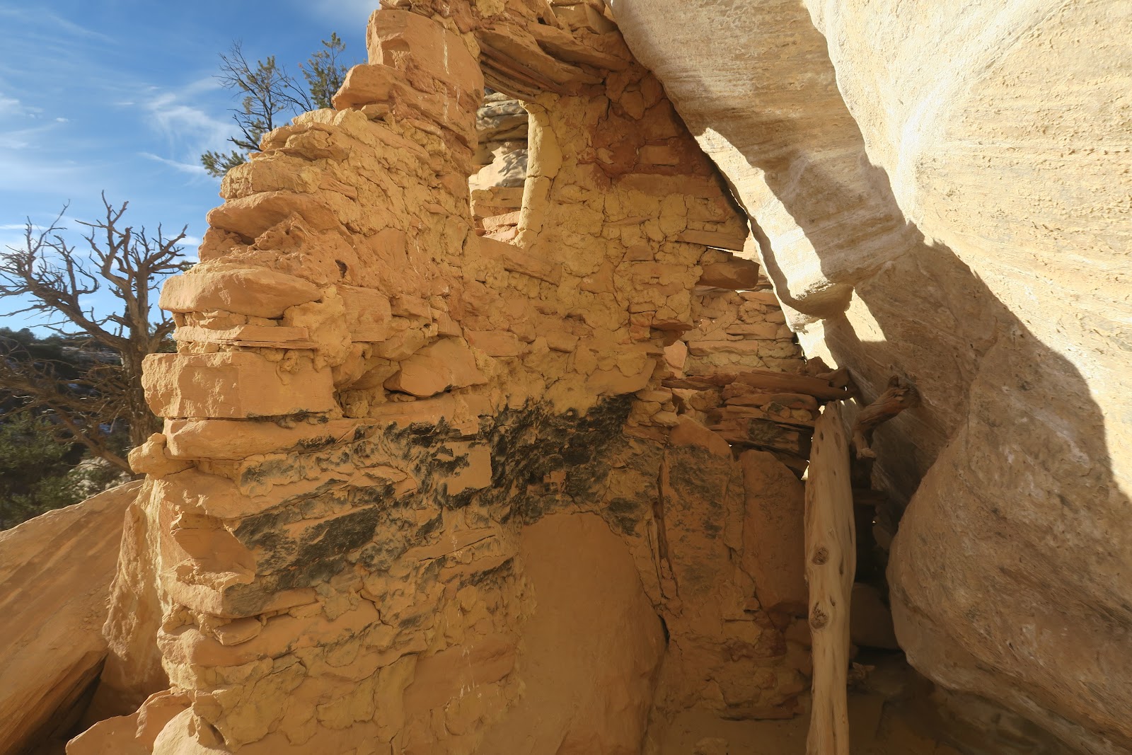
Near the trailhead, we spotted a nice ruin. Somehow we missed when we came in. It was Yellow House Ruin. It consists of several buildings and it is relatively made of yellow-colored rock, that is why I guess called Yellow House Ruin.
The structure is quite nicely preserved. The roof is impressive. As you can see in the left picture, the lashing is very nicely observed. Neat work. I imagine it would take a lot of time to make these.
Another room is above the first floor. Cool. A part of inside is black. Probably fire was used in the room.
We enjoyed the Yellow House Ruin in the evening light and went back to the trailhead.
2024-05-03
Corona Arch, Bowtie Arch, Pinto Arch
This is a fantastic hike. One hike for three arches!
This is a very popular hike, because it is close to the city of Moab (actually closest arch from Moab), and it is only 3.8 miles to see all of three arches. It is located in BLM (Bureau of Land Management), not any National Park (Arches National Park), so no need to do entering permit hustle these days needed for a popular National Park visit including nearby Arches National Park. Indeed when Mr.N hiked to Corona arch for some time ago, there were so many people. He remembers that it was not possible to take a picture of Corona arch without people, and the parking lot was full and overflowed. In contrast, this time, there were only a couple of cars in the parking, and we had plenty of time to have the arch ourselves. Firstly because it was in December. Also, it was cold day afternoon after morning snow. I consider it lucky.
 |
| Corona Arch |
Corona arch is really cool. It is a beautiful round shape as if it was filed. In this hike, you can walk under the Corona Arch and see it from both side, which is nice. The picture above was taken after we went under the arch to the other side.
 |
| Bowtie arch and Corona arch |
On the way to the Corona arch, there is Bowtie arch as you can see in the above picture in the left side. Obviously you can't walk under the Bowtie arch. The naming is quite convincing. It does look like a bowtie.
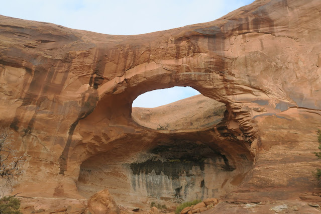 |
| Pinto Arch |
Pinto Arch is another interesting arch to check it out. It almost looks like a bridge (I guess water goes through it), but I'm not a geologist. The hole is above your head. The rounded hall area has nice colored plants.
Three arch is different and unique, and enjoyed the variety. Very happy to see all the arches in few people around.
Subscribe to:
Comments (Atom)


