2024-11-22

Ladies Pass Loop, Washington

 Another beautiful backpacking in Alpine Lakes Wilderness, Washington. 

Actually this was the first overnight backpacking before we did the Enchantments during our 2024 summer Washington trip. It was pretty, but at the same time, unforgettably tough camping situation. Below is the story. 

Day1: Chatter Creek Trailhead to Lake Edna 

5.8 miles, 4900 feet elevation gain 

The previous day we arrived midnight in Seattle and this day we shopped at REI and Walmart for fuel, freeze-dried backpacking food, trail mix, bars, and so on. Then we had to drive to the trailhead. Due to that our start time was around 3 p.m. It was a super hot day at least 30C+ (at least 86F or above). Several hikers who were shirtless on the top, came down to the trailhead said to us, "Stay cool" 

Without much shade, I got quite tired after 2000 feet elevation gain. There we found a nice shade in the forest with stream and took a break and got water. We saw some nice camp spots around there and thought about stopping for the day, but then we would have to hike more than 18 miles on the next day. So we pushed ourselves for another 2900 feet elevation climb. Luckily the daylight is long in August.  In the evening we made it to the Lake Edna. 
Lake Edna
We pitched a tent and I took pictures of evening sky (above picture). Pretty! I was happy until this sky observing. Then we were about to prepare dinner. Then we heard the sounds of thunders. Not a good sign. It seems clouds were rolling in. We just ate bars and quickly brushed teeth and went to bed. Storm got closer. Seconds between thunder lightning and sounds got closer and closer and sounds got louder and louder. Inside the tent got wet every minute, because we had a single-wall tent. At one point, we noticed that our crocks were floating in the pond, meaning our tent is in the pond. Apparently we pitched a tent in the lower place where all the water streamed in. We had to get out in the middle of night and had to move the tent to the slightly higher place. In the process, everything got wet. Even after the first storm had gone, the another one came. Then the third one came. Mr.N got really cold and he had to warm water and put in a water bottle and put it in the armpit to avoid hypothermia several rounds. Luckily I had very high quality down jacket from Montbell. This is extremely warm in the very cold environment. (I am not related to Montbell business). 
sunrise 

time to dry everything
Finally a little after the third storm, clouds went away and sun rose. Can you see the picture in the left, water is accumulated in the lower place? Our tent was even lower place than that. Once sun came in, we were happy that we could dry things out. You can see in the picture 1) how we spread out all the things to dry, and 2) how tent is wet by opened vestibule stick to the tent, 3) my warm Montbell down jacket inside the tent. We went down to Lake Edna to get water and we saw a backpacker also getting water. Her group had to move their tent too due to the storm. We celebrated the fact we survived. Lake Edna in the morning was really pretty and it was grateful to see blue sky reflecting on it (below picture). 


Day2: Lake Edna to trailhead

~15 miles, 500 feet up, 4100 feet loss


Lake Edna

Lake Edna

After we took time packing up, we started hiking towards Ladies Pass. Yes, this area's lakes are all ladies names. We saw Lake Edna, Ladies Pass, Upper and Lower Florence Lakes, Lake Mary, Lake Margaret. We didn't pass by, but there are Lake Grace, Lake Alice, Loch Eileen, Lake Ethel in the nearby area. Now Lake Edna is below (left picture). 


Ladies Pass

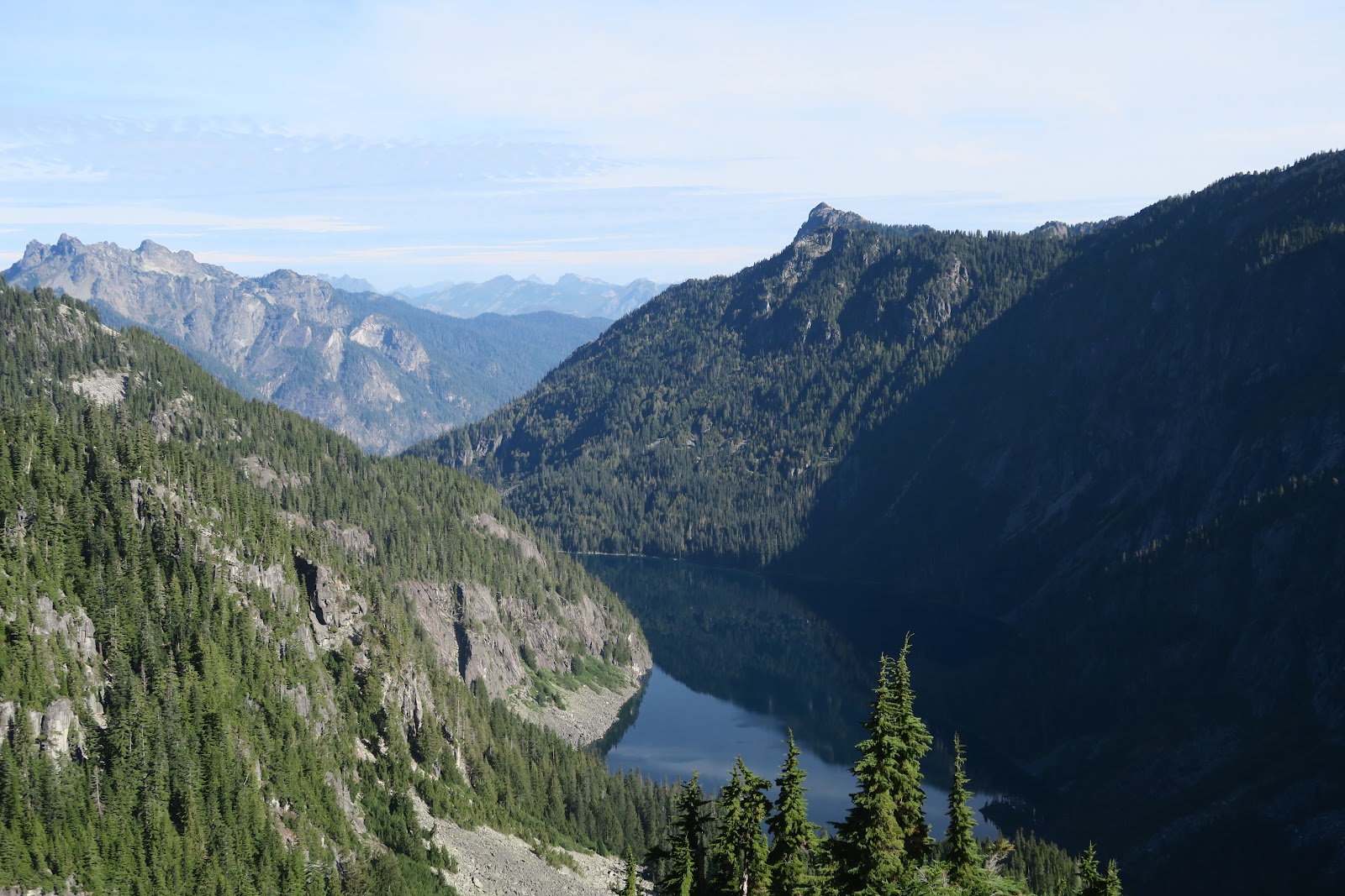
After a little climb, little down to the Ladies pass. What a spectacular view! It was a nice exception going to the pass by downhill. I take it. 
Marmot family
We saw marmot family. Look at the left picture. Babies are quarreling. Mother marmot is looking at them like, "sigh, again" I asked if it was Mr.N and Mr.F and their mother Ms.L. 

Upper Florence Lake


We took a 0.4 mile spur trail to Upper Florence lake. It was great green. How mesmerizing. We had some snack here to enjoy the color. 

Upper Florence Lake

Looking back Upper Florence was wonderful sight, too. Worth the 0.8 mile walk effort!

Then we enjoyed Lake Mary and Lake Margaret. 
Lake Mary

Lake Margaret

Icicle creek


When we came to the point to cross Icicle creek, we saw a broken bridge. There was no sign to prohibit crossing it. It did not look safe. We looked for the place to ford, but the river was big. We saw two hikers taking break nearby and asked where they crossed the river. The guy said, "Oh we just crossed the bridge" 
Oh ohhhhh kaaaay. We crossed, but it was ridiculous Washington forest service did not do anything about this. The trailhead at the end is not the starting point and we had a choice. 3 mile road walk or hitch hike. We decided to do this way: Mr.N hike 3 miles without backpacks bring a car, and I wait at the trailhead at the end and guard the packs. Luckily Mr.N got a hitch 1 minute after he started walking by very nice local hikers. 

Overall, great scenery with terrible camping night. 

2024-11-08

Big Heart Lake-Necklace Vally Loop, Washington

Another fantastic backpacking in Washington. 

Big Heart Lake-Necklace Valley loop in Alpine Lakes Wilderness.

Total 24.6 miles (39.6 km) with 7300 feet (2225 meters) elevation gain

We did 2 nights/3 days, but the third day was only 1 mile. Did that way, because it was easier to camp in wilderness rather than hike out and search for a car campground or dispersed camp on the 2nd night. 1 nighter (full 2 days) is doable for this loop, but one needs to consider off-trail portion takes much longer than on-trail. Despite that,  some trail runners do this loop in a day.

Day1: West Fork Foss River trailhead to Chetwoot Lake

11 miles, 4000 feet elevation gain

First, the trail starts with rain forest. Washington gets a lot of rain for sure. It reminded me of the Hilo area of Big Island, Hawaii. It was another great trip we had a couple of years ago.


There is a very big tree! I don't know what kind of tree it is, but very tall as well as big diameter. Can you see the phone at the bottom of tree? It gives you the scale. 
Only a few mile hike in, you will see Trout lake. Some campers were still there for packing up. Since the previous night was big rain, I admired them. 
The trail is going up and up. The falls, Malachite falls (left picture) in the mist were pretty. Some people were day hikers going to Big Heart lake, some are only forest section to collect mushrooms. 
There is a 0.3 mile spur trail to Malachite Lake. It's only 0.6 mile addition, so we checked it out. Since nobody does spur trail (I admit that I am not a fan of spur in New England, but I DO spur in the West), it was peaceful and beautiful. Reflection of the mountains on the lake was amazing. It was cloudy in the morning, but some blue sky came in here. Still it was chilly and Mr.N didn't swim (surprising). We had lunch here. Our typical lunch is tuna pack and crackers. 
copper lake

Back to the main trail, now very big Copper lake appeared. Another nice lake. It is only 3970 feet here, but looks like alpine lake. Also, I was surprised that so many pikas live such low elevation. In Sierra, they live much higher elevation like 8000 feet above. Here you constantly hear "peeee!" during the hike. Interestingly, pikas here don't show up their appearance(shy),  although they are very vocal. In Sierra or Wyoming or Idaho, without effort, you see so many pikas. Here, even we stop and try to find where they are, because so many pika's voice was heard, it was impossible to see them. 


Little Heart Lake

 The next lake is Little Heart Lake. The color is attractive green. Compared to Copper lake, there is no access to the shore and the view is partially blocked. The trail quickly goes off the lake, but good to see a glimpse of it. 


Big Heart Lake
The next lake is Big Heart Lake. The left picture is the first view of Big Heart lake. Another different blue color. There are many kinds of blue here in one day. It is grateful to see such a variety of blue colors lake after lake. More importantly, they are all beautiful. 


Big Heart Lake
The edge of the lake has such blue color, then 5 minutes walk, the color changes and see the very big part of Big Heart Lake. The official trail ends here and most day hikers stop here and go back, which is 15 mile day hike. Day hikers usually take pictures and rest on the jammed logs you see in the left picture. From here, the off-trail section starts.  


Big Heart Lake

Although it is off-trail, clearly it used to be an official trail, since we saw signs of maintenance done long time ago. The old trail goes up and now see the Big Heart Lake below. More up and up, finally I was able to understand why it is called Big Heart Lake. The picture below explains clearly. 
Big Heart Lake


Big Heart Lake
Now the other end of Big Heart Lake can be seen. It IS big! I love the person who named Big Heart Lake. 

Other side of the lake is also different great blue. 
Other side we could see Trout lake below far away which was the first lake of the day. In the left picture, you see Trout lake in the distance and bigger Delta lake nearby. This can tell how much we climbed. Leaving the Big Heart Lake, the trail got more and more obscure and we took some time to travel. Only a short section after official trail used to be trail and other sections are actually off-trail.

Angeline Lake
The trail stays up, so it is not possible to go to shore, but Angeline lake is super pretty. This lake's blue is the most vivid blue I have ever seen in the wilderness. This is fascinating. 

Chetwoot Lake


Then we arrived at Chetwoot Lake. We set up a tent, and had delicious dinner. 


Day2: Chetwoot Lake to Necklace Valley, 1 mile before trailhead

13.6 miles, 3000 feet elevation gain

Chetwoot Lake

2nd day is sunny and we started the rest of off-trail. Going up the talus field and looking pretty Chetwoot lake below. From here some carin are helpful but took some time to find a correct route to the Iron Cap Lake. 


Iron Cap Lake

Another color is added to the list of lake colors at Iron Cap Lake. 


Otter Lake
Trail doesn't go there but Otter Lake was visible. I can't count the number of lakes anymore. 

Then great glacier mountain in the view!

Summit Chief Mountain, Middle Chief Peak, Little Big Chief Mountain. 

Chief series

Tank Lake with Chief Mountains! My favorite view of this backpacking. Someday I want to camp at Tank Lake. 
Tank Lake

After Tank Lake, it goes down down down the Necklace Valley. Once official trail comes back, it was much easier to hike. Love Washington hikes.