2025-06-06

Barrier Canyon Style Rock Art, Sego Canyon

So Fascinating to see Barrier Canyon Style Rock Art. 

One of the focus in 2024 Winter Trip to Utah was seeing Barrier Canyon Style Rock art. I previously wrote about Horseshoe Canyon hike to see Barrier Canyon Style (actually same as Horseshoe canyon) rock art. In Horseshoe Canyon we saw Holy Ghost Panel. Holy Ghost Panel is the most famous Barrier Canyon Style rock art. Besides that, Sego canyon is also a great place to see Barrier Canyon Style Rock art. For Holy Ghost Panel, you need to hike 10 miles, but for Sego Canyon, only 0.1 mile, which is good for people physically difficult to hike 10 miles. 

Barrier Canyon Style Rock art is found in Southeast Utah mainly. It is made a long time ago, as far as 7800 BCE.  Some are new as 500 BCE. Rock art is more known as Native Americans like Anasazi or Fremont style, which is more recent like 1000 years ago. Barrier Canyon style is really distinct from those. I really think Barrie Canyon style is fascinating. When I see them, I feel somewhat scary, sacred, and my soul is something connected with those images. Hard to explain. You need to really see them in person. 

The below picture is the most striking panel in Sego Canyon. This panel is really high. You see the top of tree is the bottom of the panel. Also you can tell how big the panel is based on the trees on the ground and on the top of cliff. The ground level might be higher when the panel was made, but still upper section of the panel cannot be reached easily. How could they paint these? 


The second picture above is the section of panel zoomed in. Looks like alien, especially the most left person with big "hole" eyes. The left picture is the focus of that one. Everyone has some decoration on their heads like horns. Those are made from lines. Some have earrings. 
This one in the left has chains of circles (another solid circle in the each circle). Each circle is connected with multiple lines. What does this mean? Interesting. 

Head's decoration has two layers. First with two thicker lines, then thinner three lines on them. So much detailed design. 

Due to the long time exposure and erosion, it looks like some rocks were fell off over the time.

This is another set of panel. This time it is petroglyph. Another detailed design. Decoration with circles for neckless. Each one's head has many decorations. The right person is crying?! The style of the humans are triangles. Huge shoulder width reminds me of the shape of Olympic swimmer body shape. 

Some panels are unfortunately vandalized heavily, although BLM erased some of them. It is still worth visiting here and you WILL feel the Barrier Canyon soul floating around. 

2025-05-23

Fiery Furnace, Arches National Park, Utah

 Fiery Furnace in Arches National Park. Relatively unknown in Arches.

When it comes to Arches, Delicate Arch is the first one people go. Actually Arches has much, MUCH more. 

Fiery Furnace hike needs to get a permit and you need to watch a video and listen to a short talk from a ranger at the Visitor center before the hike in the early morning. There is no official trail, and the whole purpose is "get lost" in the Fiery Furnace. Despite that, most people go to the same attraction spots of arches and interesting viewpoints. Due to internet, all are listed on whole kinds of hiking Apps. Another level people go to Fiery Furnace for canyoneering with ropes. I am not into that, so we sticked to the normal route. 


Overview
First of all, why is it called Fiery Furnace? The left picture is the overview of Fiery Furnace area and it explains everything....well for native English speakers.  For non-native English speakers need dictionary to understand. 

On the second thought, it doesn't need to know how it is named. Just accept the interesting geological shapes and enjoy is more natural thing. That removes the prejudice of the perception of places. 


Surprise Arch
From outside of Fiery Furnace area, arches cannot be visible, but once inside you can enjoy multiple arches and interesting shapes of rocks. The right picture is the first arch we saw. Surprise Arch.  


Kissing Turtle Arch


Kissing Turtle Arch. Cute huh?


Skull Arch
Skull Arch. This is my favorite spot in Fiery Furnace hike. It is very interesting two holes right each other, like glasses. In the future it is probably going to be just one hole in my guess. We had a snack here by looking up this. Very good time. 


I don't know what it is, but interesting shape (left picture). When it is not an arch, literally nobody explores. Nice to get solitude. 

Bottom is another structure, similar to kissing turtle arch, but with stripes. 


Overall it is a short hike around 3 miles. It is great to see some hidden arches in Arches National Park. A little hectic to do permit/pickup thing. To be honest, I wouldn't come back too soon due to low level of solitude, but doing once is a good experience. 


2025-05-09

Upper Muley Twist Canyon + Strike Valley, Capitol Reef National Park, Utah

 Very remote and solitude hike in National Park. 

With recent increased crowds in National Park, it is almost impossible to have a hike without anybody in National Park these days. This hike is an exception and exceptional. We did not see a single person for the entire hike of 10.3 miles + dirt road drive of 6 miles. The hike is scenic every single step. 

Upper Muley Twist Canyon is a hike within Capitol Reef National Park in Utah. It is 9.5 mile day hike of loli pop. The same trailhead has a short hike, 0.8 mile total, to the Strike Valley overview as well. We did both. It includes walking in wash and rim with some navigation, thus mileage is just an approximate. 

This hike has so many arches to see on the first half of hike, and the other half has massive vast valley view. From beginning to the end, it was quite a view packing day. The left picture is the very first arch to see. Very nice weather and the sunlight perfectly illuminate the arch and makes it look even more glorious. 
It is not only arches to see. Many magnificent rocks to see. The moon was in the blue sky and it added the uniqueness of the scene. 
More arch! Smooth 
More. Every arch is different. This one is fat. Reminded me of Phipps arch, another very fat arch in the Escalante area. 
More.
After looking at various arches from wash walk, climbing up to the ridge and coming back towards the trailhead. This way has a vast view like left picture. In some portions on the ridge, the left side is the vast view, and the right side is looking down the wash and the arches below. Looking down at the arches already looked up before was great. 
Even after the hike of 10 miles, still joy continues. The 6 mile of dirt road drive is super scenic as well. Next three pictures are the arches along the dirt road. What a day!
Double arch. 
Another double arch up high. 


2025-04-25

Cold Spring Cave, Buttler Wash, Utah


Cold Spring Cave is a great spot to look at the ruin in Butler Wash, Utah. It is only 2 mile out and back. Many things to look at the dwelling. 


Adults' handprints

First is there are many handprints. Obviously some are adult size handprints, and interestingly there are many small handprints, possibly children's handprints. It is common to see handprints in Anasazi ruin spots, but I don't recall to see small handprints. 

The left picture shows upper row with bigger handprints and lower row with small handprints. Considering their relatively small body sizes compared to modern human, it could be all adults. Interestingly there are two colors of handprints, orange color is easier to see in the picture but you might notice there are several white color handprints as well. 
The left picture shows more clear white handprints. Big hands. 
Another pattern and color of handprints. Spiral handprints? Interesting. 

Okay, I talked a lot about handprints, but there is so much to see at this site. The left picture is kiva. Nicely preserved the structure of round shaped kiva. 
A part of kiva structure. Fire is involved in the kiva (black stain) and the hole is likely to be air flow to keep the fire going. It is great to see this structure long after there kiva ceremony. 
Another fascinating thing about this site is that you can see numerous grinder places like you see in the left picture. Corn, flour, whatever was ground here. Even corn is left in the hole. One corn is about the size of middle index finger. Their corns are much much smaller than modern corns. At the cove, we saw easily more than 30 grinder places. I guess many people lived there! Interestingly animal (bighorn sheep) petroglyph is observed right under the grinding place. I had never seen petroglyph and grinder just next each other. 
Finally, the left picture is cold spring in the cave. The reason why this hike is called cold spring cave. Clearly people chose this place for living due to reliable water (and good water) source in the dry desert. This is the most back of all the buildings, kiva, granaries. 


Before the spring, there is tall wall with peep holes (left picture). Likely to protect spring. We saw 3 people from nearby town Bluff in the cave and she told us that people (especially women/children) here hid back of the tall wall when enemy came and check them through the peep holes. As I mentioned in the other entry about Moon House, each peep hole is designed to check a specific direction. Interestingly, the big rock used here at the bottom of wall has holes used for grinding. It is vertical, so my hypothesis is that, they used the big rock used to be grinding area to make the defending wall to be tall. Because cave is relatively dark due to limited sunlight coming, the light from peep holes are shining in the picture. 

The lady from Bluff was quite surprised about the fact we came to the Cold Spring Cave all the way from Mass. She said that she had never even seen people from New England before. She said, "Are you lost?" 

She said that several hundreds of curving rock can be found in the cold spring cave as you can see in the left picture. It might be used to make motor (between rocks to make wall, ruin etc). 

Very fascinating place. 


2025-04-12

Birthday Arch, Utah


Another great arch hike. Soooooooo many arches in the American Southwest. 

This is called Birthday Arch. I don't know why it is called that way, but we gave it a try, because we were camping nearby. 
This hike is near the town Big Water, Utah. There are some dispersed camping in the area and since we camped at one of them, we hiked this one. Parking lot is just along the road. Maybe 2-3 cars can be parked. There was no car there and we did not see anybody in the entire hike. 5 miles of out and back hike. 
Little Arch

First attraction of this hike is "Little Arch"
It was indeed little, so it was hard to locate, but isn't it neat? Over the Little Arch, you can see the remnant of morning sunrise orange. It was nice crisp morning. 


Going down to the Wash


Then we went down to the main wash that leads to Birthday Arch, we went down the pretty pink rock. It is wavy (left picture). 

Birthday Arch

After some walk in the wash, rock walk leads to the arch. It is actually hard to spot the arch from distance, as you can see in the left picture. As you get closer to the arch, it gets more clear that it IS an arch. It is possible to go right under the arch. Much bigger than I anticipated as you can see in the below picture. Interestingly the wall behind the arch has cool stripes with black and white and brown. We had early lunch under the arch. Priceless time. 
Birthday Arch

Stripes

Another interesting stripes near the arch. 3D stripes! I don't know how these were made, but fascinating. 


After we enjoyed Birthday Arch, we went other side of wash to another small arch. In the above picture, can you see the Birthday arch through this little arch? It is nice to see two arch in one! Then we trace back to the parking lot. The last part of the hike was tedious because we had to walk a mile on a very sandy section just along the road. Despite that, still worth the effort to see Birthday arch. 


2025-04-04

Toadstool Hoodoos, Utah

This is the most accessible and easiest day hike within the Grand Staircase Escalante National Monument. 

It's only about 2 miles total (out and back) with little elevation change. The parking is along the paved road, meaning no worries about dirt road driving. Most trails start along dirt road  in Grand Staircase, so this is unusual. The downside of this hike is that you can't expect solitude, which is always the case for Grand Staircase. The parking lot had more than 20 cars when we were there, since it was mid-afternoon when normal people are out for hiking. For us this was 2nd hike of the day. 

Despite the easiness, the scenery is quite striking. I think that hoodoos are the most eerie shape in the naturally made things. Yes it is geologically explained how those were created by ice wedging and I believe it, but still I am like "How come this weird and strange shape can be made?!" 

For those who are not familiar with hoodoos, here is the Toadstool Hoodoo. 

Toadstool Hoodoo

I first saw hoodoos in Bryce Canyon National Park and those are I think most famous place for hoodoos. Actually hoodoos are not only there, they are everywhere in American Southwest. In other places you can observe hoodoos in more solitude way. During this 2024 winter trip in the West, we did three hoodoo day hikes. This Toadstool Hoodoos hike is the least solitude, but still great. Other two hikes, which were much remote, will be posted in the future. 

Despite the short distance, this hike has many things to see in addition to Toadstool Hoodoo.
Left picture has an interesting two color layers. How clear the line between brown and white colors is. Amazing. Beyond the Toadstool Hoodoos, there is no official trail but you can just walk around. 
There are at least 50 hoodoos in the area. It is really bizarre feeling and interesting to see how unique each hoodoo is. 

Another interesting color bands scenery. This is the very West view. The blue sky is terrific. 

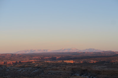
After we enjoyed this mid-afternoon fantastic hike, we headed for the evening-sunset hike (third hike of the day) when normal people go to a restaurant for dinner. 

2025-03-14

Wolfman Panel, Butler Wash, Utah

Wolfman Panel is really interesting petroglyph and special. 

There are several things often observed in petroglyphs and pictographs in the American Southwest including bighorn sheep, spiral, wavy lines, etc, but here in the Wolfman Panel is unique. 
Wolfman Panel

Picture above, I think that it contain the "Wolfman"
The main person in the middle with long fingers and big leg toes. He seems to have some power. Left and right bottom of the panel has distinct wolf footprint. They are much bigger than actual wolf footprints but there might be some meaning why it is big. I guess this combination of wolf footprints and a man makes the panel called Wolfman. Wolfman is pretty big. May 2 meters. Although the name is Wolfman, the panel is not only that. There are many unusual pictograph as you can see. I see a bird with big wing. Two big eyes? in the right, and so on. Sadly bullet holes are everywhere, but I just oversee it.
Wolfman Panel continues


Another interesting thing on the panel. The middle reminded me of "ObakenoQtaro", Japanese anime character. I am 200% sure the creator didn't mean it. Wikipedia for the anime is below. 

https://en.wikipedia.org/wiki/Obake_no_Q-Tar%C5%8D

Left is interesting figure as well. It looks to me a faucet but there was no faucet there where this was depicted. The right was a sort of plant? 
More interesting shape in the left picture, although highly damaged by bullet holes. It is a perfect circle and there is another shape inside the circle. It might be hard to guess the size by picture, but it is very big actually. Maybe bullet hole size helps to guess the size of petroglyph.


With harsh environment and limited food source and tough life, making this big panel is a lot of work I guess. Thus this panel must have ment a lot for Anasazi people. Why did they make this? To pray? For fun? Imagining their life is fun and never ending. 


Other side of the canyon from Wolfman panel, we noticed that there is ruin there. Also there is a used path to it. Why not check out?!
There are so many pieces of pottery scattered. Never have enough time to check  them all out, but we spent significant amount of time to enjoy each piece's pattern and colors. I wonder the Anasazi broke these potteries intentionally when they disappeared abruptly. 
Ruin is well preserved and really worth to check out by going down the canyon and up. 
Around the ruin, there are at least 100 pictograph. It is really interesting but can't put all the pictograph here. We enjoyed A LOT. Near the ruin, the item they curved were relatively common stuff, such as spiral, bighorn sheep etc as I put two representative picture in the left. 


Butler Wash area is relatively remote but it is good access from Bluff. From parking to the Wolfman panel is less than a mile of walk . Worth checking it out. 

2025-02-28

Druid Arch/Chesler Park Loop, Canyonlands National Park

December 2024, I visited Canyonlands National Park in Utah for the second time.

First time I visited Canyonlands NP was in 2014 winter. This time is exactly a decade later in 2024 winter. Since this NP is huge, it never be a shortage of hikes. 

This time we did a big day hike: 15 miles including Druid Arch and Chesler Park loop.  Usually people go to only Druid Arch (10 mile hike) or Chesler Park separately but since the first 2 miles are overlapped, we decided to do in a single hike.

Elephant Hill region
The hike starts in the Elephant Hill area. Interesting round-shaped rocks can be seen. We started early in the morning and the rocks are pretty reflecting the first light of the day. After that, mostly the walk is in the wash. Only the last quarter mile is steep to the Druid arch. 

Arch. You might imagine an arch is more circular arch shape, but natural arch can be various shape. Look at Druid Arch! Isn't it a bit different than the arch you imagine? It is very cool shape.  
Druid Arch

We enjoyed the arch view for a while by ourselves! What a treat. Then we moved on going to Chesler Park. It is a quite unique park. If you are there, you can tell why it is called "park", because there is big field of green and it is surrounded by interesting tall rocks. The picture below you can get a sense. 
Chesler Park


Chesler Park
Many many rocks of combined spire continues. It was really pleasant walk in the Chesler Park. Great point about this hike is there is variety. After some time in the Chesler Park, the trail goes into slot canyon called the Joint. It is quite short, but fun. We took time to enjoy every nice view and had a great day! 
Chesler Park

Joint trail