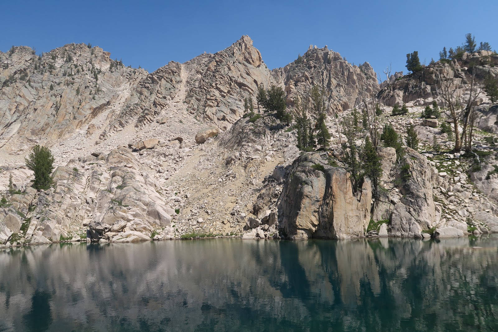
2023-08-13

Three Sisters Loop, Oregon

Once again summer vacation came! 

We started 2023 summer with Three Sisters Loop in Oregon.


Three Sisters Loop is in the Three Sisters Wilderness in Oregon. It is called that way because there are three distinct massive mountains lines together: North Sister (10094'), Middle Sister (10053') and South Sister (10358). Some mountains around the three sisters have names related to family. The Husband (7524'), the Wife (7054'), Little Brother (7810'), and Mount Bachelor (9068'). During the three sisters loop hike, you can see all of the family. The loop was about 63 miles total (including 2 side trips we did). 

Permit is required for the corresponding trailhead you start. Also pass to park at the trailhead is required. 

Let's begin the journal day by day.

Day1: Pole Creek Trailhead to Collier Cone base

The loop itself doesn't have any direct trailhead. You need to hike in outside of the loop. The closest to the trail of the loop is Pole Creek trailhead. 1.4 mile approach to the loop. The most popular trailhead is Obsidian trailhead, which is 4.1 mile to the loop. The reason why people like Obsidian trailhead is no need to drive dirt road. To reach Pole Creek trailhead, there is 20 minutes' dirt road drive, but that is very well maintained smooth road: no problem with sedan. I already knew that the Pole Creek area was burned due to Pole Creek Fire in 2012, but the damage was much bigger than I thought. It was already vast burned area during the drive to the trailhead, although low height plants were abundant and mother deer and two fawn were seen: the sign of recovery. After 11 years, still the burn was massive and it looked to me that another five decades needed to recover. There were only 3-4 cars at the trailhead. We excitedly started the adventure and hiked easy 1.4 mile to reach the loop. The 1.4 mile was maintained well and there was no single deadfall. Once you reached the loop, we found a lot of, really a looooooooot of fallen trees on the trail. We lost trail many times, because there were too many dead trees and trail was not clear at all. Since there was no live trees under 90 degree F, and strong sunshine without shade, it was quite hot. This Pole Creek Fire burned area continued 9 miles. I need to admit that this was not really a pleasant hike. The picture below gives you an idea how it looks like after 11 years of Pole Creek Fire.
South Sister in the Pole Creek Fire Area

Due to the fire, actually I could say that the view is better. You can see South Sister through the burned forest. Before the fire, I'm sure it was rather monotonous view of forest. On the first day, we only saw 6 hikers. One party had 4 backpackers with dogs. The other party of two. That's it. After 9 miles, finally the Pole Creek Fire area was over, and we entered the interesting area. The first thing we saw was lava.
Lava with snow
First night camp spot

All sisters are volcano, and lava is everywhere. It is really an interesting area. Once the Pole Creek Fire are is over, the landscape dramatically changed. I am certain that I had never seen that such a lot of lava stays with massive snow. Black lava looked really hot at 90F, but with snow. It was a little eerie, but cool scene. Soon after walking between lab, we passed by Collier Cone.  After around 12 miles, we found a sweet spot with small stream from snow melt and called it a first day. It is the (live) trees, but on the small hills and there is a nice view of North and Middle Sisters and Little Brother. There are mosquitoes but with mosquito net in the head, and mosquito pants and jacket, it was manageable for me. As usual, without any protection, Mr.N didn't get any bites (he claimed two bites, but I didn't see any swelling on the skin and they were not itchy. Every single bite of mine has huge swelling and it is extremely itchy for days). 

Day2: Collier Cone base - side trip to summit Collier Cone-south of Linton Meadow

On the 2nd day we started with a side trip to the Collier Cone. Actually we didn't plan to go all the way to the top, but it looked easy so I continued to the top and Mr.N followed. Going up the ridge and first sight I saw was like this.
North and Middle Sisters and Little Brother

WOW! 

From left, North Sister, Middle sister in the middle, and Little brother in the right. This is the Collier Glacier viewpoint. Obviously a lot of glacier is melt and now have some glacier lakes and moraine on the slope of Little Brother....but still an amazing view. 

Going to Collier Cone
It is funny that Little Brother seems "shy" and hide behind Middle Sister from many direction. Here he is visible. 

It is really hard to leave just checking out the viewpoint, we continued walking on the ridge toward North Sister, which is the way to go to the top of Collier Cone. In the picture left is the walk to the Collier Cone summit. From Mr.N's size, you can tell how massive the landscape is. 


Closer look of North Sister
Going up the Collier Cone, now North Sisters other side got visible. Other side has glacier and more knife edged type terrain. It is now really clear these sisters and brother are all volcano. It is impressive look. While we were sitting on the summit of Collier Cone, a part of glacier fell. Big sounds echoed in the mountains. How cool it is. 


From Collier Cone
Other side of view from Collier Cone was really interesting, too. The color is unique. Special geology in the region. I was so glad that view is much more interesting and incredible compared to burned area on Day1.


Obsidian
After the side trip, we back to the main loop trail. Now the obsidian area. As you can see in the left picture, a lot of obsidian on the trail. Sharp and shiny. The connecting trail to the Obsidian trailhead is in the area. It is an obvious naming. 
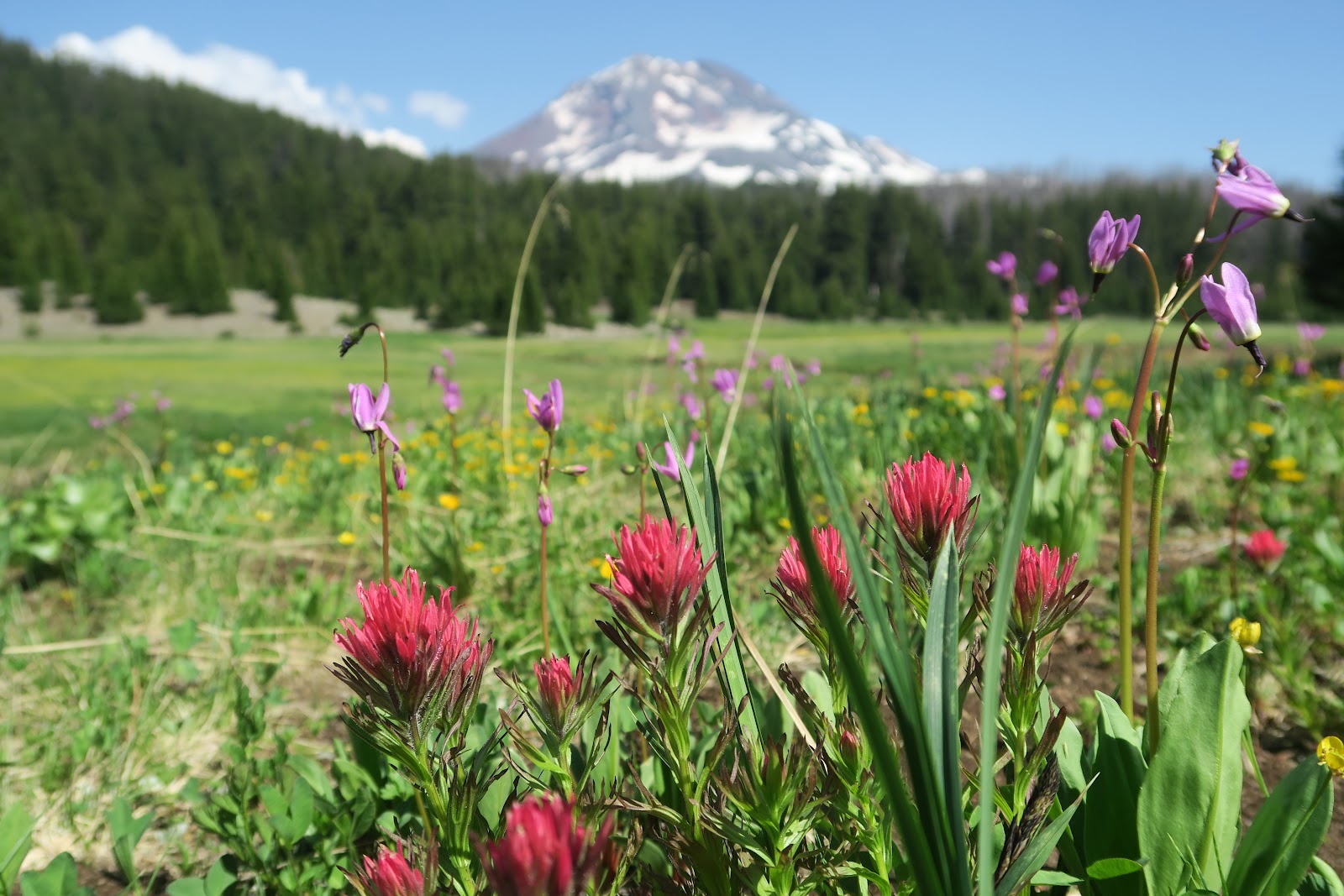


Linton Meadow
Day 2 is really view packed going through meadows and open field. There are two highlighted meadows: Sunshine Meadow and Linton Meadow. Both meadows have streams and full of colorful wild flowers. For planning we read a book "Backpacking Oregon" by Douglas Lorain, and Linton Meadow sounded like his favorite. He wrote Linton Meadow is crowded with hikers, but surprisingly we did not see a single hiker there. It was a pure peaceful place.

Open view

Between meadows are more volcanic terrain as you can see in the left picture. On the 2nd day, almost non-stopping view of sisters either from meadows or from dry fields. What a treat! We set a camp a little after Linton Meadow on that day.


Day3: South of Linton Meadow to Moraine Lake

3rd day was another pretty day. Again, it was view packed. Mesa Creek area had full of colorful flowers. This would be a nice place to camp and spend evening there, but it was like 9 a.m. we were there. 


We had snack along the stream. It was a sunny spot. I went behind tree area for the restroom break. Ugh! I got surrounded by 100 mosquitoes immediately, but I had to do my business... such a pain especially for female bathroom break. 


The Wife and The Husband
Here, I need to mention that there is a viewpoint you can see both The Wife and The Husband. In the left craggy mountain is The Wife. In the distance in the right is The Husband. In this angle, I thought that they want to be closer. Interestingly, when I posted this picture, one person commented that yelling each other. Well, it is your perspective how you interpret this scene.

Wickiup Plain
The next area after Mesa Creek wild flower area is Wickiup Plain. Vast pumice. I like hiking pumice a lot, so I enjoyed the area. The view of South Sister is great. During the Wickiup Plain, we left PCT and went east. We met probably about 10-15 PCT hikers: all fast. We talked with a guy and he said he started at Mexico border, but he had to skip Sierra due to record snow. It is certainly a wise choice, but at the same time this year they miss one of the best portion of PCT. Now I am really glad I did John Muir Trail in July on a record snow low year.

Moraine Lake with Broken Top
This day we decided to stop early at 1:15 p.m. This is quite unusual for us. We usually hike until at least 5 p.m. The reason is that we planned to hike up to South Sister on the following day. That is a side trip and the side trip trail starts at Moraine Lake. We got a great camping spot at Moraine Lake. At Moraine Lake, backpackers are required to stay at the designated spot. There are about 20 campsites. There is sign indicating a spot. On the way to the Moraine lake, a random backpacker told us site#3 is the best, because #3 can see both South Sister and Broken Top view.
Moraine Lake with South Sister

Indeed. The proof is the left two pictures. Above picture has Broken Top view and the below picture has South sister view. Awesome campsite. This is my favorite campsite during the loop. We set up the camp, went down to the beach of the lake and I soaked my legs. Mr.N swam.
We had a very relaxed afternoon.


Day4: Hike to South Sister, then go to Green Lakes

Moraine Lake and Broken Top
We got up at 3 a.m. and started hiking up to South Sister. Moraine Lake was very beautiful at the dawn. The sky behind the mountain ridge is orange. 3 a.m. sounds crazy, but there are always crazier people. I saw in the distance in the mountain, two head lamps were moving toward the top. We are not the craziest hikers. Since this can be a day hike, many people would be expected. 


On the way up
It was amazing to see the first sunlight got showcasing the South Sister as I climb it. Beautiful! After a couple of false summits, we made it to the top area. It was a surreal view that never be able to be seen from the bottom. The big snowfield on the top flat area and the center has a little melt. 


summit area
 Since we started early, the summit area was not so crowded. We took out time to observe the surrounding area. South Sister summit is one of the most beautiful and stunning place I have even been. From the top, you see Middle and North Sisters. What an amazing view! What the view really unique is the pattern of snow patches. The snow white quite highlights on the volcanic color mountains and the pattern is so pretty. Everyday the pattern would be different, so the view on that day is unique to my heart and it ever lasts as my memory.
At the South Sister top

We came back to our camp around 1 pm and we packed up and hike to the Green Lakes. It is again a very pretty area. The most stunning view I remember the most is the next morning's South Sister reflection on Green Lake.
Green Lake


Day5: Green Lakes to Pole Creek Trailhead

Dead falls

The last day was hiking out. After we enjoyed calf beautiful Green lake in the early morning, hiked some open meadows and forest, then did a small side trip to Golden Lake which has a perfect Broken Top view. After Park Meadow, we came back to the area of Pole Creek Fire. Again, hundreds of dead falls. Imagine trail is like left picture for 3 miles. You need to climb over and it slowed one down. Indeed, two people we met Green Lake area, they started at Pole Creek trailhead and their original plan was camp at Green Lake and go back to Pole Creek trailhead. Due to such tedious trail, they said they would hike out south of Green Lake, and try to hitch back to Pole Creek trailhead. They said that we were brave to do whole loop with such trail. We also met a couple with a toddler near the Pole Creek Trail junction where the dead falls were not yet started. They were ambitious: plan to a whole loop with a toddler as eight figure (half way they would resupply). It would be a lot of work ahead for them. I bet they stopped first half of 8 figure. 

Overall, I enjoyed an amazing mountain view, interesting volcanic geology, colorful flowers. Loved the three sisters. I someday come back to scramble up to the Middle Sister!


2023-02-20

Watching Manatees, Florida

2022 winter break, we went to Florida. The main purpose is to see manatees! 

I had not known about manatees until several years ago when I first went to Florida. During that trip, I only saw 2 manatees once. I wanted to see manatees again. So this time we drove to Florida. 

Manatees are mammals living in the ocean. They are "sea elephants". Their closest animal is indeed elephants. They are out in the sea in the warm season, but in the winter, they get frostbite in the far out ocean. Therefore they come near the springs in Florida. Springs are the same warm temperature all over the year, so those are the safe place to spend winter for them.

First, we camped at Blue Spring State Park. Blue springs are crystal clear and very beautiful green colored water. The rangers there counts manatees everyday. For my surprise, the day we were there, about 620 manatees were there! Can you believe that? I had never seen so many sea mammals in one sight.
manatees!


more manatees
They are very calm, just laying down in the warm water. It was amazing how clear the water was. There are adults manatees and some kids. You can see in the left picture the size difference of them. Since Blue Spring has sooooo many manatees, swimming or kayaking are prohibited. It makes sense. However other parks where less manatees are concentrated, kayaking and swimming are allowed. So we went there to check it out. 


We kayaked in Tarpon Hole. Here, we were able to kayak, and even snorkel! Snorkeling was really cold, but we had an unforgettable experience. Seeing a manatee in the ocean. So cute. Very big. Bigger than I had expected. The shape is like a baked potato. It swam by me peacefully. What a wonderful moment to be there. 10+ more people were around snorkeling there, but we were the only people WITHOUT water suits. Because other people were from a guided tour, so they were provided with swim suits, and when then left, the guide was telling them that hot drinks were waiting on the boat. Well, we had insulated mug filled with coffee. Although it was Florida, the cold storm hit all U.S., and it got cold even in Florida. Next time I will definitely bring water suits.
MANATEE!!!


Then we went kayaking in another place, Manatee Park. This park does not have spring, but serves as winter refuge for manatees. Why? They come to the Florida Power and Light warm water canal. Power Plant Discharge Canal is in the state park. Canal itself is not allowed to kayak, but the river connected to canal is allowed. Manatees are really congested in the canal, but great amount of manatees also go out for river to eat and rest. Kayaking to see those is really nice. During kayak, we saw 100+ manatees, but we saw very memorable 2 manatees. One manatee, near the canal, bumped into our kayak. The ranger in the park said manatees are very curious animals. Wow.


manatee
The second one was more memorable. One manatee came just along the kayak and stayed for 10 minutes! I saw his nose open to breathe, and I even felt air moving coming from his nose! then his nose closed when he went into water. I had a Canon yellow water camera and I put it into water. The manatee might be interested in it. In the left picture the orange is our kayak and the manatee right next to me!!! In the below picture, you can even see his hair. One of features of mammal, they have hairs.


2023-01-20

Island Lake Backpacking, Uintas, Utah

 This is the very last overnight backpacking in our 2022 summer trip. In Idaho, we completed all the backpackings ahead of schedule. It was good because wildfire grew. We escaped from smoke and drove to Uintas wilderness in Utah. We did a fantastic 2 nighter including Kings Peak, which is Utah's highest point. Then we still had 2 days left. Kings Peak loop is the most famous backpacking in Uintass, and we didn't have an idea what else would be good. I looked at Uintas map and decided to give it a try to go to Island Lake. Overall, I liked it, but I admit that not as dramatic scenery as King's Loop one. However, it is still memorable and nice. 

As I mentioned it was not popular, there was no pure backpackers on the way, however, we saw 3 people in a group and solo person for hunting. It was a hunting season in mid-September. One guy said that it is unusual to see a non-hunter person in the area. From trailhead to Island lake was in the forest. Once we reached the Island lake, the trail got faint and we had a little hard time to find a clue of old trail. The usage of trail in that area is very low. We set up a camp, and we hiked up to the pass over the Island lake. The view from basin on the other side of Island lake was really marvelous. Iconic color of Uintas' rock color and vast basin was quite a scene to be. We enjoyed the view with warm evening light shining up the basin.
Great view

On the next day we got up early and had the last breakfast of the trip. It was really quiet morning. I saw an elk sprinted along the Island Lake. Maybe he had a sip from lake. The inlet of the lake was near our campsite was the best water I had ever. It was refreshing, cold, clear, pure, and tasty. We talked about our friend Mr.S1 who likes good water: he would be jealous.
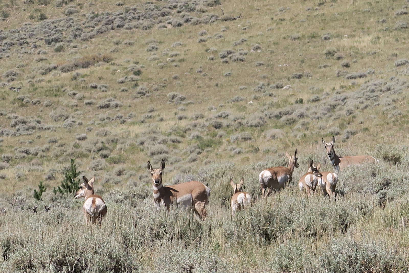
Antelope

Lastly we had bonus. Antelope. I saw antelope in Wyoming in the past. It was first time seeing in Utah. They are always cute and gave us great gift as a finale of this trip.

2023-01-07

King's Peak Backpacking, Uintas, Utah

I fell in love with Uintas Wilderness. 

I had never heard of Uintas Wilderness in Utah, but 2022 summer I had an opportunity to backpack there for four days. If you are a (hardcore) reader of my blog, you might think that we were backpacking in Idaho in 2022 summer. Yes, you are correct. The reason we headed for Utah for the last four days was that the wildfire that started during our Idaho hiking was getting severe. Another reason was that all the itinerary we planned in Idaho was finished ahead of schedule. Due to those reasons, we decided to go somewhere else free of wildfires. We anyway had to go to Utah to fly back to Boston, we searched trails in Utah area, preferably near Salt Lake City where we were going to fly. Uintas Wilderness caught my eye and suggested to Mr.N. There is the highest point of Utah in the wilderness and he liked the "highest in Utah" phrase. Then within an hour of finding it, we already on the road. The first one hour of Idaho section was really really smokey. It was kind of yellow world, because sunlight came through thick smoke in the sky. After an hour and half, we got out of the smoke and it was clear. 

We camped at the campground at the China Meadow trailhead. It was past Labor day, so it was free!

The first day we hiked around 10 miles. All the way was really pretty. I really enjoyed meadow and mountain scenery. One of the spots we took a bread was like this below picture.
What a view

 
3 moose

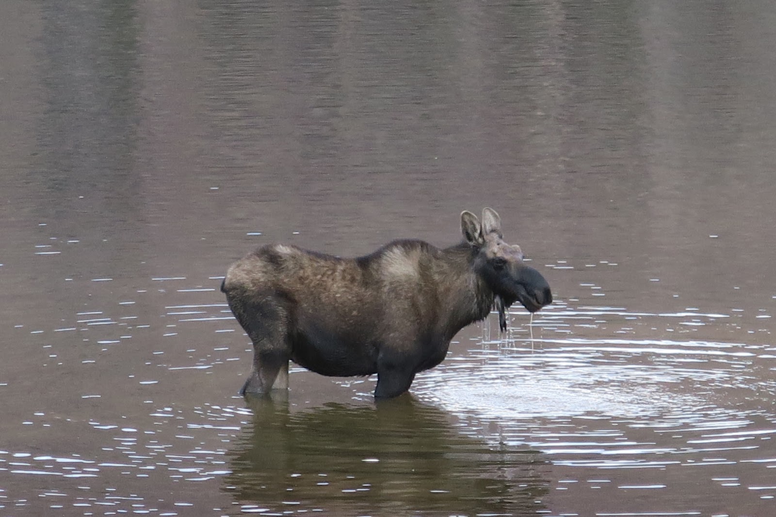
Colors of mountains are quite different from Idaho. Each has unique beauty and enjoyed the varieties of places. We continued hiking on the meadow toward the first pass. Our plan was camping the first night somewhere not too close to the pass so that we could hike up the pass in the early morning. When we reached Henry's Fork Lake, the time was a little early like 4 p.m. for concluding a day. We usually hike until 5 or 6, sometimes until 7 p.m. However, we got a reason to stop. Many moose in the lake!!!!! In the left picture you can see three moose. On the grass across the lake is a mother and a child. One moose I was able to see a good picture by standing not too far.
eating a lot
She ate a lot for a long time. There must be their favorite plants in the lake. We saw total 5-6 moose in the lake and the shore. Interestingly, they are all females and a kid. 

We set up a camp and observed moose. It was precious time. After we enjoyed seeing therm, we saw a couple of backpackers came from opposite way we were hiking. They shouted and and talked super loud at the lake (yahoo). The moose were scared and they ran away. Especially mother and a calf were cautious and they had to swim.
Swimming hard

The baby was not yet able to swim as fast as adult, so she had a little hard time catching up her mother (left picture).

Not good to be such loud in wild, especially near the wildlife!!!

I was sad to see them gone, but after we had dinner and tea, they came back including the mother and baby. They drank water from lake and I was happy again too.


From Kings Peak
Next morning we hiked up to the pass, then did some off-trail not to do down and up again. Then we reached to the junction to go to Kings Peak, which is the highest point of Utah state. It is not an official trail to go there. It was basically scrambling and hopping the rocks. It was tough, but not technical, just it requires stamina. 


Kings Peak sign
Although there is no official trail, the summit has a plate of King's Peak. The view was incredible at any direction 360! Unintas' unique color of beauty is amazing. I would say Uintas color is warm color: warm brown, green with red rocks. High peaks and basin below is unbelievably beautiful. I'm really happy being there at peaks and in the basin. 

The only group we saw on that day was at the King's Peak. They were doing a very long (~14 hours) day hike from a different trail we started. They are from Salt Lake City and they had to drive back on that day: loooong day for them. They, 4 guys were very fast: they called each wife at the top since there was cell reception (often very high peak has cell phone signal). It was funny that we learn the "normal world's news" at top of Utah: one of their wives said Queen Elizabeth passed away. We overheard it and Mr.N asked if it was true. The other guy said, "Yeah his wife is reliable, so seems true LOL", then other guy said, "Finally Charles is king and now anytime he could die at his age", interesting and unique memory for us. 

Other side of Kings Peak

 
Lake and Kings Peak
Then we came down to the basin. The basin was incredible. The above picture, the highest point you see on the right is Kings Peak. The rock color has golden yellow, brown, red, dark brown. The lightning is dramatic. With combination of clouds, the scene is the beauty of a moment. This scene was so strong and I felt like the beauty went through my heart, as knife pierce directly to my center of heart. We hiked through this vast basin to the next pass. The entire basin was only us. (those 4 guys went down to the other side). As we walked, there were some small lakes on the basin. It was quite pretty. 
 
2nd campsite
We again hiked up to the pass and went down to the lake and camped there.
After the pass, the rock color is really red and the region is called Red Castle.  On the third day we hiked around Red Castle. The main Red Castle area is a perfect distance for overnighter, and it happened to be weekend, so we saw a lot of people there. I was glad we camped at the different place where nobody around. I love peace and solitude in the wilderness. 
Red Castle
Red castle is in the left picture. It explains why the area is called Red castle (good I don't need to write up). We did some cross country around red castle where there is no trail so that we enjoyed quite area with lake as you see in the picture. Overall I really loved Uintas and I'm glad we explored there.


2022-12-09

Bench Lakes Backpacking, Idaho

Bench Lakes, Sawtooth, Idaho

Total Mileage: 12-15 mile(half of the hike is off-trail)

Total elevation gain: 3,000 feet? (a lot of off-trail, I am not sure)


Scenery: 9
Solitude: 9
Difficulty: 8

Our itinerary: 1 night 2 days

Day1: Hike through 1st, 2nd, 3rd, 4th, then camp at 5th Bench Lake
Day2: Hike Out

There are five bench lakes in Sawtooth. Let's do it all.

There is an official trail to the first bench lake from Redfish lake. Redfish lake is a pretty big lake and commercial boat service is run from one side to the other. On the day we hiked, obviously there was no boat service. Why were we sure about it? The reason was Ross Fork fire. It was not very close, but close enough to see smoke. In the middle of our Idaho hiking trip in Sawtooth, the Ross Fork fire started, and by the time we were hiking to Bench Lakes, it got bigger. We observed that two fire department planes were getting water from Redfish lake and headed for the fire every 15 minutes. It was really cool to see the plane touched the lake and went up to the sky again. The time for the planes to be on the lake was just 10 seconds. It was impressive that it is possible to collect water in such short time. I was able to take pictures of those moments.

getting water
Another great moment along Redfish lake was that we ran into an Idahoan couple we met at the top of Thompson peak on a previous day. They day hiked to Thompson and the next day they went to Bench lakes. We stayed at the lake overnight, and hiked out in the morning and started hiking toward Bench Lakes in the afternoon. When we were heading to Bench lakes they were on the way back from Bench lakes. It was a great meeting. They are very friendly, talkative, and nice. 

3rd Bench Lake
Among five Bench lakes, I liked 4th and 5th. Further hiked, the lake got more alpine-ish, and it was completely nobody after 4th. The left picture is the 3rd Bench Lake. Water was really clear and transparent blue. So peaceful. Mr.N went into lake as usual. I had snack and took pictures while his diving time as usual. 

4th to 5th Bench Lake was a little tricky, since it was off-trail. There was a used trail from the edge of 3rd lake to the 4th, but to find it we had to do some bush-whacking.
5th Bench Lake


5th Bench Lake was incredible. Nobody else, and we could get an awesome campsite along the lake. As you can see in the left picture, another great iconic sawtooth shaped mountains are standing tall behind the lake. Not many people reach the 5th lake, which made me feel the place really a hidden gem. 

We hiked so much in Sawtooth and absolutely loved Sawtooth mountains. 


2022-11-25

Thompson Peak, Sawtooth, Idaho

Thompson Peak, Sawtooth, Idaho

Total Mileage: 12.3 mile

Total elevation gain: 4,000 feet


Scenery: 10
Solitude: 7
Difficulty: 7

Our itinerary: 1 night 2 days

Day1: Hike to unnamed lake, set a camp, summit Thompson peak
Day2: Hike Out

INCREDIBLE VIEW!

I loved the scenery: both the lake and from the summit.

I first learned about this hike on a random person's blog. Since we had decided to go to Sawtooth for summer adventure, I studied the area by books and internet. For books, I used "Backpacking Idaho" by Wilderness Press. The book is more focused on a long backpacking, mostly over 30 miles. For Thompson peak, although more than half is off-trail, the distance is 12 miles, so the book didn't cover it. On the blog I saw the Thompson peak looked really nice. Why not doing it?

Lake!


There are two ways to do: a long day hike or overnight backpacking. We thought it would be great to spend a night at a lake. Half way to go to the lake is on the official trail, but after that technically not official, but used trail are there all the way to the lake. The lake is amazing. It is surrounded by Thompson peak and spire-like mountain. The water color is greenish blue reflecting sun. Beautiful. Some people hike to for the lake. Without summit, it is still worth coming to the lake. We set up a tent at the lake, then went off to the Thompson peak with a day pack. From here, it is officially off-trail. 

On the way to the top

This is probably a most popular off-trail hike in Sawtooth, so there are enough carins for us to navigate to the top. Basically it is not technical, just a lot of scrambling on talus. Tiring but doable if if you have stamina. Talus we climb is in the left picture. You can get an idea. 


Almost there
 

The last portion of climb was very steep: the next picture. Then the view was waiting after that. The lake we set up tent was now right under the summit. I had never seen the lake in that way. Almost like I was looking at the lake from just above it. It was unbelievable I was at the lake level several hours ago and now looking at the same lake in a totally different way. The same lake appears different from the top. Color was different, shape was different, size was different, although it IS a same thing.
From the top


We saw a nice couple from Idaho. They did Thompson as a day hike. They were really surprised that we came from all the way to Idaho from Mass! They are from Pocatello, 4 hours away from Sawtooth. They said that they were debating how many hours to drive for hiking, but they said that we totally beat them.

We took a lot of picture, ate a lot of food, and enjoyed the view a lot at the top!

Camp!
Spending a night at the lake was really pleasant. This is my favorite camping spot among the entire Idaho trip, although it was a little windy and due to that not Mr.N's favorite spot. Yes, indeed it is not a good place to pitch a tent if it is very windy, or there is a risk for thunderstorm. However, it was sunny day and no thunderstorm that day, so it was okay to do that. The view was incredible in the evening differently. The lake color became much more dark blue, the rock became much more dark brown. By sun setting gradually, the entire world color kept changing. How lucky eating dinner with seeing it. 


sunrise
This camping spot was awesome, because not only having the entire lake view by ourselves, but also having great view on the other side. We were able to see pretty pink color with alpen glow over the mountain range in the evening, then in the morning we were able to see a beautiful sunrise. It is nice to see White Cloud mountain range where we were backpacking a few days back. There is a distinctive white color mountain in the range and from Sawtooth the white mountain was really visible since that white is extremely different from surrounding mountains. It was really beautiful standing out like princess! After we enjoyed sunrise and breakfast entirely ourselves in peace, we hiked out. GREAT!


2022-11-11

Pettit Lake Loop in Sawtooth , Idhao

Pettit Lake Loop, Sawtooth, Idaho

Total Mileage: 35.5 miles (including side-trips)

Total elevation gain: 7,200 feet


Scenery: 10
Solitude: 7
Difficulty: 7

Our itinerary: 2 nights 3 days

Day1: Tin Cup Trailhead --Imogene Lake through Alice Lake
Day2: Imogene Lake layover
Day3: Hike out

On the way to Pettit Lake Campground

A night before starting we camped at the car campground at the trailhead (Pettit Lake Campground). It was $17 with no supplies. No potable water is provided, the restroom was super far. I would never pay $17 for that! Anyway. On the way to Pettit Lake Campground from White Cloud Peaks range, we saw huge smoke in the distance, but not too far away. Also we saw a tiny smoke in the Sawtooth range which is near the hike we were going to do. When we saw the smoke as you see in he picture, we weren't even sure if the trail was open. The trail was open, and people were hiking there. We saw a fire ranger walking around the campground, so we asked if it was safe to hike the Pettit Lake loop. She said that the fire wouldn't come to Sawtooth based on geology. There are few mountain ranges between the fire and Sawtooth, and no way to come to the Sawtooth. She was confident. The small one in the Sawtooth was really small, but she suggested that hikers avoid the last part of the loop although technically it was open. 


Pettit Lake
Next morning, we started the loop by hiking along the Pettit Lake. Despite the name, Pettit Lake is quite big. Smoke was calmed down in the morning. McDonald Peak was reflecting on the calm Pettit Lake, which was very nice.

Next lake after Pettit Lake is Alice Lake. The way to Alice is continuous climb but gentle. Alice lake is one of the most popular destinations of day hikers. Indeed we saw 10+ day hikers heading to Alice Lake, but surprisingly at Alice, we didn't see anybody. The reason is probably because we were not only at the shore where trail was, but we explore some peninsula portions on the Alice. At the quiet area at Alice Lake, the view was gorgeous as you can see in the below picture. What an iconic "sawtooth-ish" mountains and attractive aqua blue lake reflecting sunlight!

It was a sunny warm day, so I dipped my leg into lake until knee-high. Even I entered the lake: of course Mr.N swam. I took pictures and chocolate while he did.
Alice Lake

 
After Alice Lake, the next attraction was Twin Lakes. As the name indicates, two lakes are next each other. It is beautiful enough to see along the shore of each lake, but even more amazing when twin lakes were seen from pass 9800. Even Alice Lake can been seen from the pass. Lakes are surrounded by magnificent mountains. How cool the view is. You can see the smoke is coming from fire over the mountain range in the picture. Luckily it didn't come to our side. 
Twin Lakes and Alice Lake


From pass9500

Other side of the pass is amazing, too. Two unnamed lakes were visible and the further one is milky glacier-contained color. There is not much visible glaciers anymore in Sawtooth, so I was surprised that there is still a glacier lake. Hiked through those lakes, the next big lake was Toxaway lake. Toxaway lake is a quite big (a mile long) and of course Mr.N swam there. One option was that stopping early in the day and camping there. However, it was still 3 p.m., so we decided to go to the next lake, Imogene lake. 
Toxaway Lake

To go to Imogene lake from Toxaway lake, it is needed to go through two passes. When we finally arrived at the Imogene lake it was 6 p.m. It was a taxing day. 

Small fire was north of Imogene lake, and we saw a helicopter flying that area hanging something. We guess fire fighters were dropping anti-fire chemicals or something. North of Imogene lake had some firefighter activities going on, so the ranger at campground recommended not go further than Imogene lake. We did so.

Lake Lucille
Next day, we left a tent at Imogene lake and did two day hikes from there. Both are off-trail adventures! The first one was to go to Lake Lucille. This was recommended in the book "Backpacking in Idaho" Actually there is no official name for the lake, but locals call it Lake Lucille. After some gully climbing 1.5 mile, we saw Lake Lucille quietly sitting. It was really quiet. I felt like the lake welcoming only hikers who did some extra work via off-trail. The lake color was unique. I thought that it had something charismatic power in it. Lake Lucille is under two great peaks: Mount Cramer and the Arrowhead. 

Profile Lake

From here we continued more off-trail 800 feet climb to Profile lake which is the base of Mount Cramer and the Arrowhead. Profile lake was even more hidden and I appreciate its beauty. Again the lake color was mesmerizing. It was getting hot in the middle of day, so I decided to swim in the lake. Due to high elevation and snow was still remained along the shore, the water temperature was very cold! I dipped my body in there and 10 seconds was maximum I could stay. Phew. Mr.N was able to stay for a couple of minutes, but it was too cold even for him. After we enjoyed these two lakes, we came back to Imogene lake, then went off to another short day hike to lake 8700. This was great as well, but I preferred Lake Lucille and Profile lake. 

Farley Lake

The third day, we left Imogene lake, and hiked out from a different trail. There was another great lake: Farley Lake. 

This loop was absolutely amazing and I can tell why it is popular. It is Idaho standard popular, meaning much less people than New England, meaning I still enjoyed quiet hiking and wonderful scenery.