2022-06-10

Angels Landing Again!

In 2020 winter camping trip, we did some hikes in Zion. One of them was Angels Landing. One year later in 2021 winter camping trip, we came back to Zion. And.....we hiked Angels Landing again. Last year it was snow-free hiking, but this time Zion was full of snow in January (Actually the day we hiked was Jan 2nd, 2022).

We went up to Angels Landing----if you have done it before, you know it can be dangerous. The last part to hike up to Angels Landing is quite steep with chain (speaking of chain, this is maybe similar to Japanese Alps). If the rocks were with snow and ice? Yes it adds extra challenges. However, it is more rewards. Snow in the West is really dry, meaning really powdery. That is covered with Zion-color rocks. Well, it is easier to see the picture below rather than my explanation.
Winter Zion

99% of people who go to Anegles Landing go back to trailhead after summitting, however, we as avid hikers, proceeded more on the West Rim trail. Last time we didn't do this, but this time we wanted to add some new sections. The entire West Rim trail is a multi-day backpacking thing, but this time we just hiked around a couple of miles to get taste. Below picture is one of the best view on the West Rim trail. It is really beautiful! I like the interesting triangle cone shape rock in the middle of picture. Such magnificent rock formations with pure white snow is truly an amazing view.
West Rim Trail


Another bonus for West Rim trail is deer on the snow. How cute she is. Probably fur protect from being cold on the snow? Now I have been to Zion 3 times and done these (OK nobody requested to list what I have done but I do): Angels Landing, Kolob Arch via Hop Valley trail, Northgate Peaks (off-trail), Canyon overlook trail, Chinle trail (10 miles total out and back), Emerald Pool trail, some West Rim trail, all East Rim trail. 

Still I want to go back to Zion and want to do Narrows, Subway someday.


2022-05-27

Kayaking in Moss Landing

Kayaking to see wildlife in Monterey. I wanted to do it while I lived in California, but I didn't have a chance. During 2021 winter trip we had an opportunity. Why not try it? 

We looked up and found Monterey Bay Kayaks for rentals. For 4 hours, $35/person for 2-person kayak. Not a cheap option, but it is worth it. This includes life jackets, wet suits. Staff were friendly. 

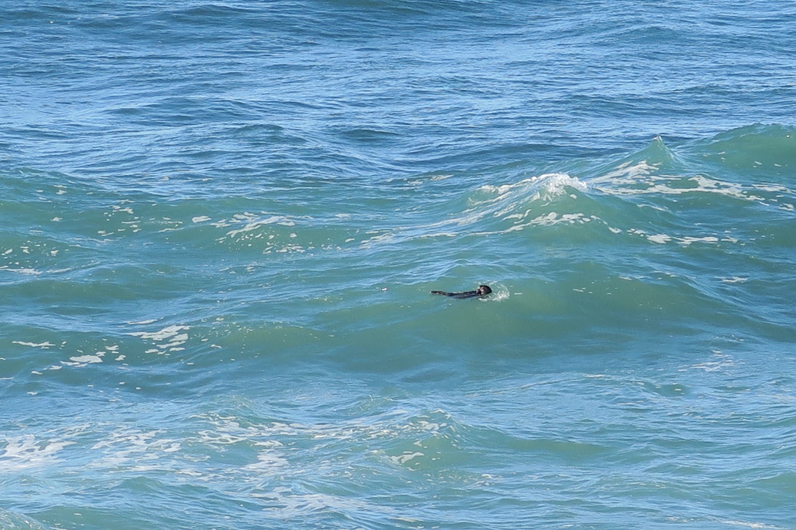
Sea otter
Got ready and we went out for the water! First part was a little rough, because it is in the ocean. Once we entered the slough part, it was much calmer and peaceful. The most exciting part is wildlife! During kayaking we saw total at least 50 sea otters!!! Some were swimming, some were catching fish, some were sleeping, some are floating. All of them looked happy and enjoying the water. I had never seen so many sea otters in a day!

Excitement is not only the number of sea otters. We saw sea otter babies! In the below picture you might be able to spot fluffy baby on the mother's belly. I believe both of them are mother + baby. 
Sea otter baby


seals
Another wildlife I enjoyed are harbor seals. Most seals were sun bathing on the shore. We also spotted several seals swimming in the water. In the left picture a number of seals are sleeping. One of them looking over the water. One black one in the front is half body in the water and sleeping. Cute cute! 
The next picture below is the swimming seal. Good at swimming in the water, but also good at swimming with head above water. 
 
 
swimming seal
In California, there is no problem kayaking at the end of December! In New England all rivers and lakes are frozen and no way to kayak. It was a good destination to go to West in winter.


2022-05-13

Montaña de Oro State Park

 Came back to Pacific Ocean! During 2021 winter trip, we decided to visit some people in California: why not go for hiking on the way then!?

Mr.N chose Montaña de Oro State Park. Mr.N is from Montana. What is the connection? He chose this particular park due to that. As you may know, Montaña means mountain in Spanish. Since California was a part of Mexico, a lot of nature stuff is called with Spanish.

We arrived at night at the park and camped at the campground inside the park (we had a reservation). This car campground is not really close to beach or ocean view, but it was spacious and still able to hear some wave sounds. Admittedly, Big Sur campground is much more attractive than this one, in terms of ocean view, but we stayed there for accommodation. 

Next morning, we saw a cat coming out from RV. That is my dream----road trip with an adventurous cat! This was my second time a cat came out of RV. First time was in New Zealand! Now RV road trip with a cat is becoming a trend?

Hiking up the hill
Anyway we started hiking to go to Valencia Peak. The highest hill in the park. As a typical California weather pattern, it was cloudy in the early morning. So the ocean was a bit gray, but still a good view. I had forgotten the weather pattern of this. Later on blue sky came out. Good timing--we started walking along the ocean. Bluff trail is about 5 miles or so, is quite nice to see blue ocean.
Arch Rock
 

Ocean and the rugged cliff creates such a nice view. I liked the view in the above picture especially. There is an arch rock! Arch rock is fragile and someday it will collapse, so I feel lucky to see it. This Pacific Ocean's blue is always my rout. Being from an island in Pacific Ocean, my DNA always feel home with this blue!

Sea otter
Another very exciting thing about Bluff trail is that you can spot sea otters. Some spots you can see 15 sea otters of group. I think that I saw total more than 50 sea otters. According to Ms.L, sea otters in this area were gone for a while, but now they came back again. It is good. 

Next day we visited Mr.N's uncle and aunt, Mr.E and Mrs.G. It was first time in five years to see them. We had sushi takeout, watched documentary, had poke, went to Mexican place. A lot of enjoyment. Kindly Mr.E let each of us drive his Tesla! Whoa. First time in life. There are so much information on the panel at front. It was fun driving Tesla along the Pacific coast in Monterey. How many lucky people can do that in the world?

Then we visited another Mr.N's aunt Ms.H. We visited San Luis National Wildlife Refuge to look at Tule Elk. It was a driving tour. I had never done driving tour in the park. It was interesting. It was nice to see elk protected: at the same time a little sad to see elk was locked in a way, although it is a huge area. Then we went to Merced National Wildlife Refuge next day, I had never seen so many many many birds in a day. This is definitely a unique place to go if you are in the area.


2022-04-29

Anza Borrego Desert State Park


 After we spent some time in Arizona, we drove to Southern California. That's a big drive---why came to Cali? We wanted to check out Anza Borrego Desert State Park!

rainbow
When I lived in CA, I wanted to go to Anza Borrego, but I didn't have an opportunity to visit it. Now there was a chance. 

It was VERY unusual when we were entering CA. It was raining. Rain in CA?! Whoa. My entire time in CA was in the severe drought. No rain at all. A bit shocking to see rain in CA, but rain was over soon and the rainbow welcomed us in the Anza Borrego. 

First hike we took was Calcite mine. As the name indicates, this is the hike to go to an old mine area. This is 4 mile round trip. There is a 4WD road to walk: well, you need to know that most of the "trail" here in the Anza Borrego is a dirt road---and 4WD vehicles used them. If you have a normal vehicle, you have to hike. This park is huge and has massive spider network of 4WD road in it. With 4WD you drive very very deep into canyon and you are allowed to camp anywhere. That would be extremely fun and able to have quite solitude. There are some actual hiking trail, too. Also, of course main roads are paved. 

So, calcite mine. Whoa, I really liked the scenery. Numerous hills have great lightning. Very interesting colors. Calcite mine area had many white nice stones with mineral people wanted in the past (I guess). Interesting.
Calcite

After this calcite mine hike in the morning we checked into the Borrego Palm Canyon campground. Campground is spacious and cozy. Most people were camping with RV and we were the only one having a tent outside in December. Compared to Utah, it was nothing for us.
Calcite
 
Calcite

Next, we headed for a hike "the slot". I found this interesting by hiking App before the trip. Also by searching the internet, small section of 4WD road of the trailhead is doable with 2WD. We found that the road is good condition and reached the trailhead without any problem. Then....this should be a popular hike, but no car in the parking lot. Found that the trail was closed! No sign at the turn off to the dirt road from paved road. 

The slot
Ummm. It was disappointing, but at least I could get an idea from the trailhead. The left picture the inside of canyon is the trail. 

OK fine---let's go to the next hike. We next headed for William Kenyon Overlook trail--1 mile round trip. This is near another campground (Yaqui Pass campground). The view was gorgeous. Nobody was hiking there and it was absolutely ours. In the afternoon even not much cars were on the road. Quite peacefully I very much enjoyed the scene: nice warm sun hitting the immense desert.
William Kenyon Overlook


Before sunrise
Sun coming
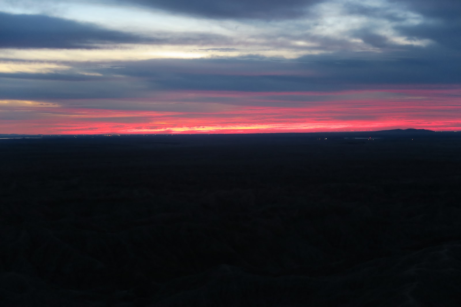
Day2: we got up around 3 a.m. to go to see sunrise at Fonts Point. First, we drove to the point where the dirt road starts. Dirt road to the Fonts Point is 4 miles. 4WD can drive, but it is too sandy for 2WD. We walked the dirt road in the dark. Then we arrived the Fonts Point 1 hour before sunrise. We boiled water and had a cup of coffee while waiting. I took some pictures with long exposure. There were stars and in the distance a little bit of light from small airport can be seen. Then sun was coming. The horizon got firing red as you can see in the left picture. It was really nice to see every moment's change in the golden spot. Nobody else around! Not many people wake up for sunrise. It was cloudy, and I admit it was not the perfect day, but still it was nice to see the sunrise there. Fonts Point is known for a great spot for sunrise and sunset. Due to thousands of small hills, the lightning dramatically changes when light source is setting or rising. 
Sun came out
After a while, sun came out from the clouds. Now hills were visible by eyes. It was really pretty. After we enjoyed the solitude, 1 car arrived (2 humans and a dog). Now time to walk the ridge of Fonts Point.
Fonts Point: beautiful lightning

Every angle was pretty: I understood why Fonts Point is famous. The morning light was beautiful hitting the hills. And nobody else around---total solitude. I heard that sunset is also pretty, but I am sure solitude is not granted.
 
After sunrise we walked the side edge of Fonts Point: it was really nice. Then we walked back to the car and had lunch at picnic table near the Tamarisk Grove Campground, which is different campground we stayed.

 
Then we did some nature walk in the afternoon. First, cactus walk with signage. This was Cactus Loop Trail (1 mile). It is always nice to learn about cactus, isn't it? Then we did Yaqui Well Nature trail (1.6 mile). We somehow got off-trail, so it ended up like 2.5 mile. Good thing was we saw flower in the cactus while we were off-trail. So it was worth it. Another hiker also got off-trail and actually she was happy to see the flowers as well!
Then we did William Kenyon Over look trail (1 mile). These are all near the Tamarisk Grove Campground. Then finally Panoramic Overlook trail (1 mile) from our campground (Borrego Palm Canyon Campground).  Total around 15 mile hike from pre-dawn to dusk. I believe that we are qualified as real Borrego explorers. 

Mine
Then next day was the final day in the Anza Borrego. This day we went to the south region of Anza Borrego State Park. First we went to Carrizo Badlands Overlook. Then we hiked up to the Mine Peak. This peak is off-trail and it was fun. Harder than expected, meaning had fun. The left picture is the abandoned mine and the peak behind was our destination. This area is much more remote compared to Palm Canyon Campground area. And I actually loved this quiet area a lot.
From Mine Peak
The view from the top of mine peak was amazing. It was big vast scenery. Nobody in the visible distance. It was quiet. Although it was December, sun in the desert made it warm enough to sit down and relax for lunch break. With 4WD in the deep dirt road has guarantee for solitude, but there is solitude without it for sure, since Anza Borrego is really big area. 
Then finally we did Borrego palm Canyon Nature trail (3 mile) to conclude the Anza Borrego visit.
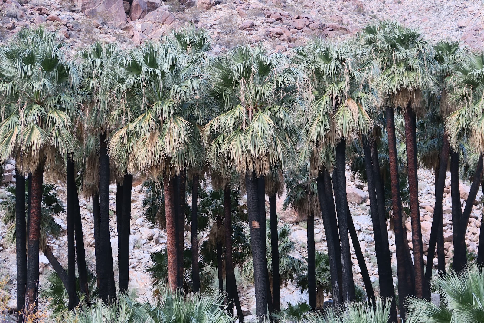
Palm


As the trail name indicates, there are palm trees at the end. You might notice that tree trunk were black. It was burnt several years ago (a hiker or child caused it) and all leaves were gone. Now leaves are back! 

Overall, we enjoyed a lot Anza Borrego.


2022-04-08

Wupatki National Monument

Wow! Another impressive buildings. 

In 1100s, thousands of people were living in the Wupatki area. In the dry desert landscape, they cultivated, hunt, gather plants. In the area there are many buildings. I was amazed how the buildings are big, tall, and still intact. 

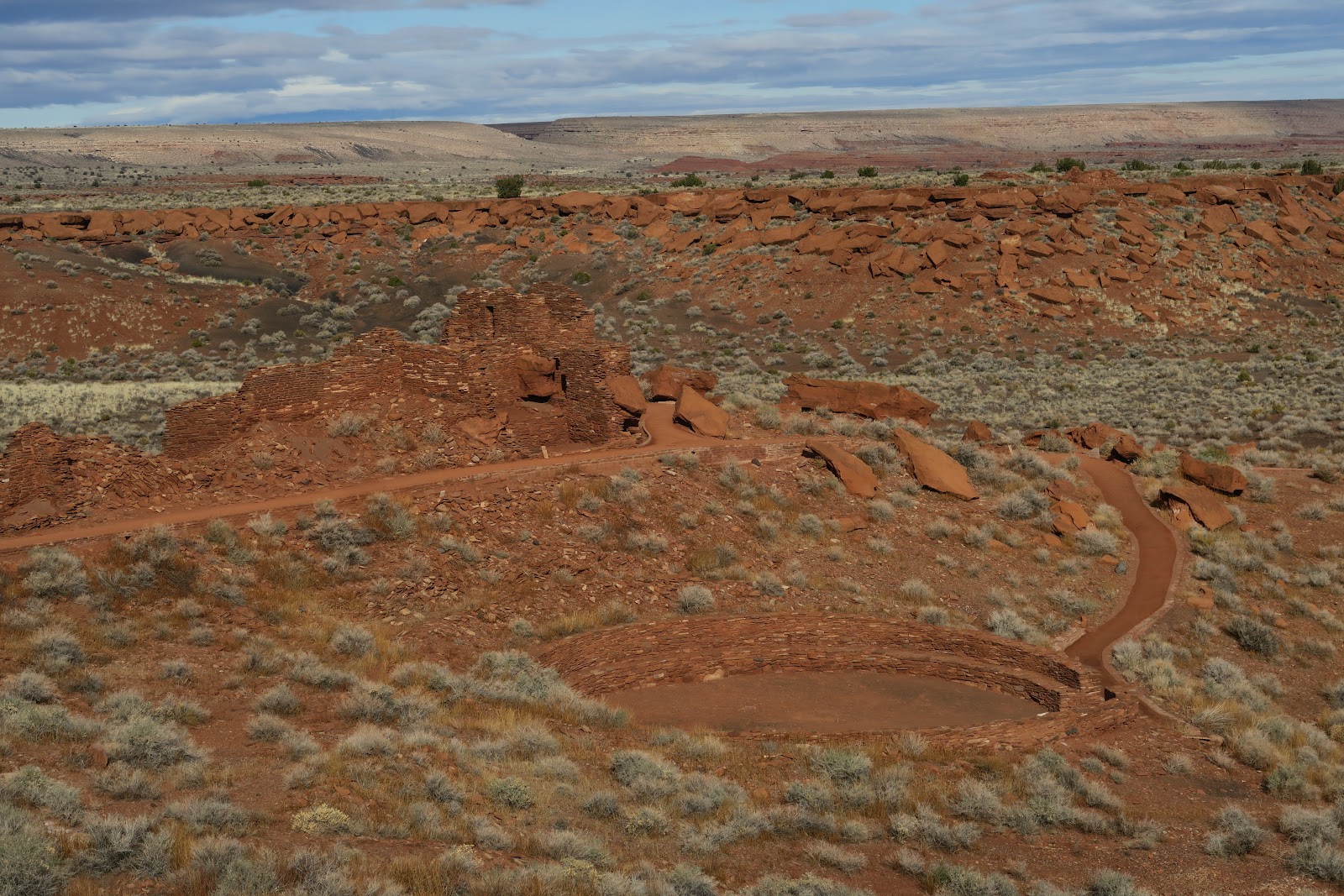
The most famous and big one is this as below picture. It has more than 100 rooms!

You can walk around the building. You see the trail in front of it in the picture below. At the trailhead you check in with a ranger and you will borrow a booklet to go to the trail. Around 15-20 numbers along the trail and you read the explanation in the booklet. 


Massive house


rock integrated
As you can see in the picture left, the building is built with utilizing the natural rock formation. I could imagine someone who were really good at designing building existed in the community. There are many holes in the wall. Either window or the hole logs were used to be in for the structure.
Ball court

Some portions are stabilized later to protect the building: however, this is challenged by Native American's philosophy---leave as it is. 

And the ball court. I had never seen a ball court. This could be used for social gathering place and also play ball games. At the edge of circle can be used as a bench. People watched the game? or watched something show at social event? Who knows but it is interesting.

This Wupatki Pueblo is the main and biggest building in the Wupatki National Monument, but there are 5 more buildings in the Monument. Actually this monument is big. Probably only a coupe of people a day look all of them. I saw most cars directly go to Wupatki Pueblo and left the Monument. We are always an exception: checked out all of them and also hiked the Doney Mountain adjacent the Monument.
Wukoki Pueblo

One of the five building is Wukoki Pueblo. This is very big as well. Nicely you could go into the dwellings: you might notice steps in the entrance portion in the left picture. The right section of building is tall. Maybe 3 story height.
inside Wukoki

As you can tell from the picture, it was a nice sunny day! In desert I love the air warm up even in the middle of winter. 
Doney mountain trail
The left pictures were taken from Doney Mountain trail. The landscape is pretty and vast. This made me realize again that how much I love the West. Dry and vast. Felt like I was melted into the scene. At the same time the life in this area must have been tough. It is impressive that so many people had amazing buildings and very rich culture here. From walking around the entire day in this region, I felt like their talking and laughing, and their soul still around.


2022-03-18

Walnut Canyon National Monument

As I wrote in a previous entry here, 17 hour hike in the wet hiking shoes made my left foot hurt. My left foot is slightly bigger than right foot. If I buy a pair of shoes, always left foot feel small, but right foot is perfect. In general, hiking makes feet swollen. If 17 hours in a shoe with swollen foot? Not good. In this trip, it got worse because the shoes were wet. 

Due to this, we changed our plan and decided to do short hikes for a couple of days. Originally we were thinking about Subway in Zion, but we instead went to a couple of more National Monuments. Actually I didn't know there are many National Monuments in Utah and Arizona.

A day after we hiked Natural Bridges National Monument, we went to Walnut Canyon National Monument. 

Cliff dwelling
About 900 years ago, in the Walnut Canyon, cliff dwelling started being built. In this canyon, so many dwelling can be seen. In the left picture, you can see some dwelling. It is amazing that they built home literally in the middle of canyon!

People who lived there are not known where they were from, but it is known that most likely plenty of plants and animal in the area attracted them. They hunted and gathered plants, as well as farmed. 

Their home
The main trail is the Island trail, which is a 0.9 mile loop trail. You can walk along the many of dwellings. There are a lot of signage and explanation of culture. It was fun learning their lives in the past. 

Their dwelling is cool. As you can see in the left picture, they were built by utilizing cliff structure. Walls are with stones and clay. Archeologists think the home was built by women. I wonder what the evidence is coming from, though. They took DNA from wall and it was always XX chromosome or something?
door and hole for smoke


The left picture is interesting. The entry door and a hole for the smoke. They used fire inside, so the smoke needs to be go outside. The top small hole is the one. You notice that the top of the entry door has log.
You can see the door top portion picture in the right picture. 

door top
in the bottom picture, you can see how the trail is next to the dwelling. It is fun, right?!

dwelling


One of the signs along the trail explained that people shout each other to the other side of house in the canyon, and also communicated with torch. Very interesting. 

People occupied these for 100 years, then they left. Why did they leave? No clue. It is considered that these people were assimilated into Hopi culture. 

In 1880s, this became a popular place for souvenir hunters and a lot of stuff was destroyed. Then 1915, to protect this area, this became National Monument. 

It was a nice little walk to explore here.

2022-03-04

Natural Bridges National Monument

I loved Natural Bridges National Monument so much!

Until we planned 2021 winter camping trip, I had never heard of Natural Bridges National Monument. I first choose Kane Gulch/Bullet canyon backpacking (wrote about in a previous entry), then I found there is Natural Bridges National Monument nearby on the map. I wondered, "Oh, what's this?" Because I love natural bridges, I looked up and found there are three bridges there. Why not checking them out if we were going to be close by!?

Natural bridges are made by running water force. Thus you would find stream or river under bridge or nearby, although not always water in the stream in the desert. On the other hand, arches are made by not the erosion of moving water, but by other forces. 

Owachomo bridge
By erosion state, bridges can be categorized young, middle, or old. In the Natural Bridges National Monument, there are three different age's bridges. 

Owachomo bridge is an old one and no longer erode by moving water, but now by others like frost. As you can see in the picture above, Owachomo bridge is very thin! It is no surprise it get collapsed tomorrow. However it could stand for 300 years more. 

Owachomo bridge is very distinctive, big bridge. It was really exciting to see it in person. The photograph gives you a sense how massive it is. When you are close, you will feel that sense 10 times more. It was super lucky to have the view only for us. From the side I was taking above picture, maybe it looks not too thin, however, now look at the below picture. This picture was taken from the other side from above. It looks really thin and I was convinced that it could fall this moment.
Owachomo bridge


Kachina bridge
Now the opposite: young bridge, which is Kachina bridge. As you can see in the left, it is very thick. It was very thick so I didn't even notice for minutes that there was a bridge ahead when I was walking on a dry creek. You see stream (although it is dry currently) is under the bridge. We sat there in the sun under Kachina bridge and had chocolate. What a luxury spot to eat chocolate. Extra happy.


Kachina bridge

It was hard to get the image to show how thick and immense Kachina bridge is. The left picture might tell you that feeling. 

It was good to see nice blue sky from both side of bridge!

Sipapu bridge

Sipapu bridge is the middle one. This is handsome and photogenic. Span is the biggest among the three. Close to the point I took the picture above, there was a ruin under alcove. Nice to live with this view, although I am sure the weather was tough at times. 
rock art

In this monument, you can hike all the three bridges in a loop (8 miles). Also you can see (look down bridges from above) them from overlook point on the scenic drive loop road. If you don't have time to hike, it is worth driving around. 


Nice view
Another option is hike 1 mile to the each bridge from road. We hiked (you can imagine?) 8 miles and saw many more that can't be seen from road. For example, these rock art. Hand stamps and maybe animal.

Hiking between those three bridges are in the canyon. It is quite a dramatic view. Some pictures in the left. Interesting rocks and good winding canyons. I can understand why these bridges were created by moving water force. 


Between bridges are canyon
It was really nice to be out there. Recommended destination for all fellow hikers!