2024-08-09

Colorado National Monument

In 2023 winter trip, our plan was to focus on the Escalante area in Utah. We ended up including Colorado. Why?

It goes back to the December 24th, Christmas eve in 2023. We enjoyed the Longbow Arch Hike, then came back to the car. We did three hikes on that day (total about 13 miles), so it was about sunset when we finished the Longbow Arch hike. We planed to go to Mule canyon the next day. We tried to see the Google map in the parking lot at the trailhead of Longbow Arch, but there was no cell phone reception. So we drove for a while about 30 minutes, then we found the area with cell phone signal. We pulled over to a turnout and parked. We used an interior car light for 10 minutes. Then we finished searching and tried to depart. Here was the problem. The engine did not start. It was about 7 p.m. on the Christmas eve. That is the exact time and day of the year when everybody is at nice dinner table in a warm house. On the other hand, we were just along the tall canyon wall, the edge of cell phone coverage in the dark, at 30F (-1C). Oh Lord, but good thing was that there was cell phone signal. We called an emergency line of Hertz. After several calls, they arranged a local repair person come to our car. During the wait, we boiled water and had a cup of coffee since we had camping gear. 2 hours later, a guy came and jumped our car. Obviously, the rental car had a malfunctioned battery. The guy suspected that the battery died. After that we had to drive to Grand Junction, Colorado, since it is the closest city that has Hertz rental car center at Grand Junction airport. The customer center told us that the option was either change the car at rental car center or change the battery at Firestone. Firestone has a contract with Hertz. We stayed at a motel in Grand Junction. 

The next day, December 25th, Christmas day, we went to the rental car center. The previous day Hertz call center told us it would be open on the 25th. However, it was closed. Other rental car companies were open. How bad Hertz is. The customer service center doesn't even know their own company's branch is closed or open? It is a surprise from Japanese perspective, but after living in the U.S for a while, it is no longer a surprise. It was actually expected like "Ah okay American"

Since the rental car center or Firestone were closed on the Christmas day, we decided to hike in the Colorado National Monument, which is only half an hour drive from Grand Junction. Then the next day on the 26th we went to Firestone and changed the battery. This is how we hiked in Colorado during the originally Utah exclusive hiking trip. I had never heard about Colorado National Monument, but glad I did check it out. Not too crowded and the people there seemed only local according to the car number plates. 

Monument Canyon
On the Christmas day we hiked Monument Canyon. This is the most highly rated hike within the Colorado National Monument. Since we were at the motel we had free Wifi, we were able to look up the hikes in the area. 4.5 mile loop with about 700 feet elevation gain. It was crispy cold morning and felt quite pleasant to hike after the car trouble. Monument Canyon is very scenic. Canyon is massive and some section had snow as you see in the picture. 


Deveil's Kitchen
After this hike, we still had time for another hike, so we hiked into Devil's kitchen. This is also highly rated hike in the Colorado National Monument. I don't know why it is called Devil's Kitchen. The left picture is the kitchen area. Interesting structure. It looks like Devil chopped rocks in the kitchen?


ice falls
Because it is only 1.5 mile out and back, we decided to combine another hike that goes to side canyon, No-Throughfare canyon. I don't know what the name means. The canyon is not particularly interesting to be honest, and we turned around at the icy falls (left picture). The most memorable hike of the day was when we came back to the junction of Devil's Kitchen trail. We saw a group of Bighorn sheep!!! Below are some pictures of them. Really precious time to observe them. Especially the big male one. He posed me and froze for a while (for me to take picures?).


2024-07-26

Cassidy Arch, Capitol Reef National Park, Utah

Another great day hike to an awesome arch. Countless impressive arches in Utah! 

This is a 5.6 mile hike with ~1000 feet elevation gain located in Capitol Reef National Park. This was my second time visiting Capitol Reef National Park. Last time I hiked to Hickman Bridge and hiked some Cohab Canyon. This time, we tried another hike. 

Grand Wash Road from trail
To go to the trailhead, after entering National Park, drive on Scenic Drive for 1.2 mile. It is already jaw-dropping scenery on the Scenic Drive as the name indicates. Then turn left into Grand Wash Road, which is a dirt road. It is quite smooth and any cars can make it to the trailhead. The parking lot is big and there are around 10 cars parked when we arrived there. After hiking in Grand Staircase, I felt 10 cars were a lot, but compared to Whites in the East, still scarce situation. 

The hike just goes up and up, but only 1000 feet gain. Every step makes the view better. Only a half way you can already see the very nice view of Cassidy arch. Since this hike ends up on the top of the arch, you can enjoy the arch view on the way to reach the top. Quite different shape of arch compared to typical arch, postcard type shape, such as Delicate arch in the Arches National Park. The picture tells everything.
Cassidy Arch

Below is the picture from the end of trail. Looking down the Cassidy arch from other side of above picture. You can walk on the arch. For some time a couple was sitting just left of the arch and some people behind the arch complained that they disturbed the pictures! LOL, I agreed. I took a below picture after they left. 

Cassidy arch hike is unique, because you can see the arch from both side, from distance and close, and from side and top. Of course it is in the National park, so you won't have solitude, but still really worth checking it out. I am glad I visited again Capitol Reef and had chance to see this spectacular Cassidy Arch.
Cassidy Arch


2024-07-12

Devils Garden, Utah


Quite interesting area to see. This is just 30 minutes to 1 hour walking not really a hike, but great place to admire the monument. It is in the Grand Staircase-Escalante National Monument, but this Devils Garden is additional protected area as Devils Garden Outstanding Natural Area. Usually there is not many signs along Hole-in-the-Rock road even at the parking area, but this one has even restroom.

The book I checked "100 classic hikes UTAH" says this Devils Garden hike can be either the first introduction to Escalante, or stop point after long hike. We did as latter. We had a big day hiking into Golden Cathedral (10 mile hike with 20 mile rough road drive), then checked out this garden. That is why the pictures above show evening sky.

This small area somehow concentrates the sandstone arches, mini-spires/towers.  These shapes are kind of bizarre and eerie. Mysterious and even I feel strange. In that sense, I feel like I was in the different world. That I often feel when I am in the Escalante area. Maybe that is the reason this is called Devil's garden? Love it.

2024-06-28

Longbow Arch, Utah

 Another great hike in the Moab area. I didn't know that there are sooooo many great hikes in the Moab area. I didn't know about Longbow Arch, but along with Jeep Arch I found it in the brochure from a grocery store in the Moab area. Since I love any kinds of arch, we decided to check this out. 

This hike has two bonus. One is dinosaur tracks. This was my first time seeing it. I didn't even know dinosaur tracks exist. Can you spot the dinosaur tracks? Two big one can be seen here. It is like a big bird track. This is under a half mile from the trailhead. Even just see this is worth it.


Right after the dinosaur, very big rock art panel is waiting. Maybe it lasts 0.2 mile even. Interesting to see some drawings are depicting hunting the animals (deer or bighorn sheep). It might be those Anasazi people's hope to hunt well. 


This left picture, a person in the right and left is trying to hunt the animal in the middle.

This is my favorite! Six people holding hands!
This is another hunting scene. Interesting.
Here is the longbow arch. The evening light hits perfectly. The color is amazing orange. Love this Utah rock color. We had snack under the arch. Always junk food is tasty in the wilderness.
On the way back to the trailhead, we saw very nice Alpen glow. All the rocks in the orange and then in the back snow capped mountains are reflecting orange sunshine. 
This is quite unique scenery because high mountains and desert rocks are in the same one view. Not only that, it is the special time point of sunset. Alpen glow in both two completely different geology. This moment stuck with me and remain in my heart.


2024-06-14

Grandstaff Canyon/Morning Glory Natural Bridge

Another day hike in the Moab area, Utah.

Mr.N had done this hike before, but he was confused due to the name during planning. Yes, the name of this canyon was changed after he hiked this. Here is the history I read on the panel at the trailhead and book. 

William Grandstaff (or Granstaff), a man of African American decent, settled in the area in late 1870. He was referred to as "Negro Bill"

This canyon was called Negro Bill Canyon because of William Grandstaff, but more tourism and attention in the area led to the petition of terminology. Then it became Grandstaff canyon since 2017.

I was a little hesitant to hike this particular canyon, because the book had a warning about poison oak. I am very sensitive to poison oak. I get severe rash with itches even indirect touch with oil from the plant. For example, when I passed by a puddle near the poison oak ( I did not touch poison oak at all), I had a small splash from the puddle. I got rash on the splash shape. If you haven't had experience, it is difficult to imagine how itchy it is by poison oak-derived inflammation. It is 100 time more itchy than mosquito bites. For a week at work, I had to put ice pack on my rash to focus on working. With ice pack my nerve lose itch sensation, but without it, no way to work on anything.

At the trailhead, along with the Grandstaff history, there is a big sign warning about poison oak. I made up my mind that I turn around anytime if no way to avoid it. I cautiously walked and I didn't get any rash this time. Phew.

Natural Bridge
The hike is short (out and back 4.5 mile) and the canyon is gorgeous. The left picture is the first sight of the natural bridge going deep into the canyon. Technically it is an arch. You can go right under the bridge and inspect it from many directions. Below two pictures you can sense how close you can reach to observe the bridge. Cool and fantastic hike. 


2024-05-31

Fisher Towers

 Another great hike not so far from Moab, but far enough to be not crowded. This is 23 mile drive from Moab, and then the last 2 miles to the trailhead is dirt road, but smooth surface. Along the way there are 5-6 BLM (Bureau of Land Management) car campgrounds. There is one at the trailhead at Fisher Towers. We camped there a day before this hike so that we could start hiking early in the morning. Now BLM got greedy and camping fee is $20 without providing anything such as water. Anyway it was convenient for hikers to do Fisher Towers. There were 3 sites, and 2 of them were occupied when we arrived there. Next site one's car was from Montana. They had a big fire with logs they brought. Mr.N (who is from Montana) said that they are not real Montanan since they had big fire, and they kept engine running during night to keep them warm (it was very cold night like 10F). I had no opinion about it and I let him say what he wanted to say.

The book I read said that Fisher Towers is more popular for rock climbers rather than hikers, but we didn't see any rock climbers or hikers during our hike. This is around 4.5 mile with 750 feet elevation change. Trail is well marked and easy to follow.
There are many impressive towers. Some towers are named such as King Fisher, Echo, Cottontail, Ancient Art, or Titan. The Titan is the biggest one. The trail goes through between towers and one can look up to them in real close. This is very cool. Some are thin walls, some are circular towers. It is magnificent to see them in a crispy morning. Another cool thing about this hiking was that the fact we did it around sunlight coming. I an glad to see a dramatic color change of towers as sun hits them.

The above picture is beginning of the hike. The left picture is on the way back of the hike. The sunlight came in and started lightening up towers. Going back is the same scenery but due to color change I was able to enjoy the view somewhat different way. 


In this hike, there is more to see. The left picture is other vast field view. The sunlight was starting to hit the hills in the distance.
After sun went up higher, the entire field was under the light. What a great view!

When we came back to the trailhead, one guy was about to start the hike. Yay our hike was in all complete solitude and maybe his.


2024-05-17

Shikes Canyon, Utah

Shikes Canyon is really really exciting! 

I had been wanting to explore Shikes Canyon for a long time. The reason is because I hiked Kane Gulch and Grand Gulch in December 2021 and knew about Shikes canyon from the map. Shikes canyon is a tributary of Grand Gulch. Since we used Kane Gulch to enter Grand Gulch we didn't have a time to explore Shikes Canyon. Very glad to come back to the Cedar Mesa area and check Shikes Canyon out. I was especially looking forward to observing Green Mask Panel in the Shikes Canyon. It turned out that I enjoyed much more than I had expected. 

The day before the hike in Shikes canyon we did a dispersed camping in BLM about 30 minutes drive away. It was a very cold morning and the car thermometer indicated at 8F (-13.3C) at the trailhead of Shikes Canyon. It was crispy air and of course no car in the parking area in such a frigid day. 

Nice building
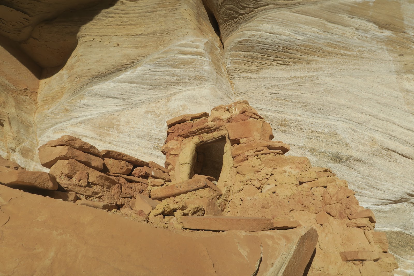
The first attraction we found in the canyon was a neat small ruin. Nice little steps to the entrance. The inside is quite small. I wonder this was a granary or one person bedroom. If it was a bedroom, literally there is only space to lay down. Ceiling is very low. It might be hard to see, but there is a faint rock art above the ruin. It is diamond shape with white color.

Next ruin we spotted was in the distance. Actually really far away in other side of canyon. You have a very good eye if you can find it in the left picture. 


I have a Canon camera that can zoom X17. The left picture is the structure I got with the camera. It is a small structure. It would take an hour to go there and seems not particularly interesting to spend so much time, so we decided to proceed. 


Nice color
The next ruin we found is nicely preserved (left picture). It is under the alcove of off-white color rock. Interestingly, the ruin's bottom part matches the color of alcove. The upper portion is made of more darker color stones. 

Next ruin we spotted was again in the other tributary canyon and very small, so we decided to not go there and proceed. 


The next one is the really impressive one. Green Mask Panel and ruins. The rock art was HUGE!!!
Here some humans without head are painted. The couple (?) drawn by dots are interesting. Each person has boobs (?) with one dot (nipple?).
Small person in the right with filled brown is a kid? No answer but free to imagine.
The left picture is another set of humans without heads. Again one person is a little bigger than the other. I read on the internet that this picture is a C-section birth: some people believe it that way. In that theory, the bigger one is a female. Between two bigger person, there is a small person with small dot that could be a head.
There are many two people drawings. This one looks like having heads. The left one is white color.
Another two people with heads. Interesting head shape. Also there are nipples (?) with another color.
Another two people. One is bigger than the other. 
To me these two people are couple, but who knows?
There is upper level with some ruins, but no way to reach there. I could see the pictoglyph there but not completely. The left is the best picture I could capture. Looks like the same counter-triangle shape humans without head. Color is nicely preserved.
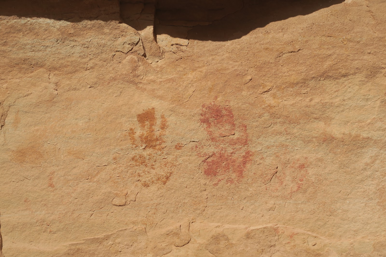
In the right you see many hand stamps. It seems relatively common in Utah. 
Left to
More hand marks.
More of them. 


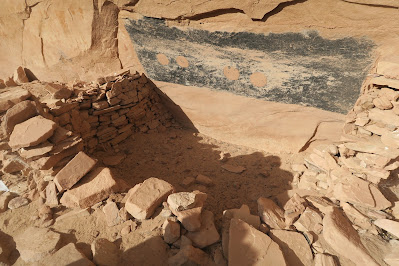
Here is an extremely interesting structure. It looks like a kiva, but not sure. The thing I had never seen was what you seen on the wall. It is painted black in rectangular shape. Then there are 4 circles painted. Zoomed in pictures for the four circles are below.


Left two circles are plain painted.


The right two have circled shape in the circle. 

There must been meaning, but why? Fascinating.


The art you don't want to miss is, Green Mask. The reason why whole art here is called Green Mask Panel. I thought that it looks like a queen. This is my first time I saw this vivid green used for the rock art. Not only green but yellow in the middle was colorful too.


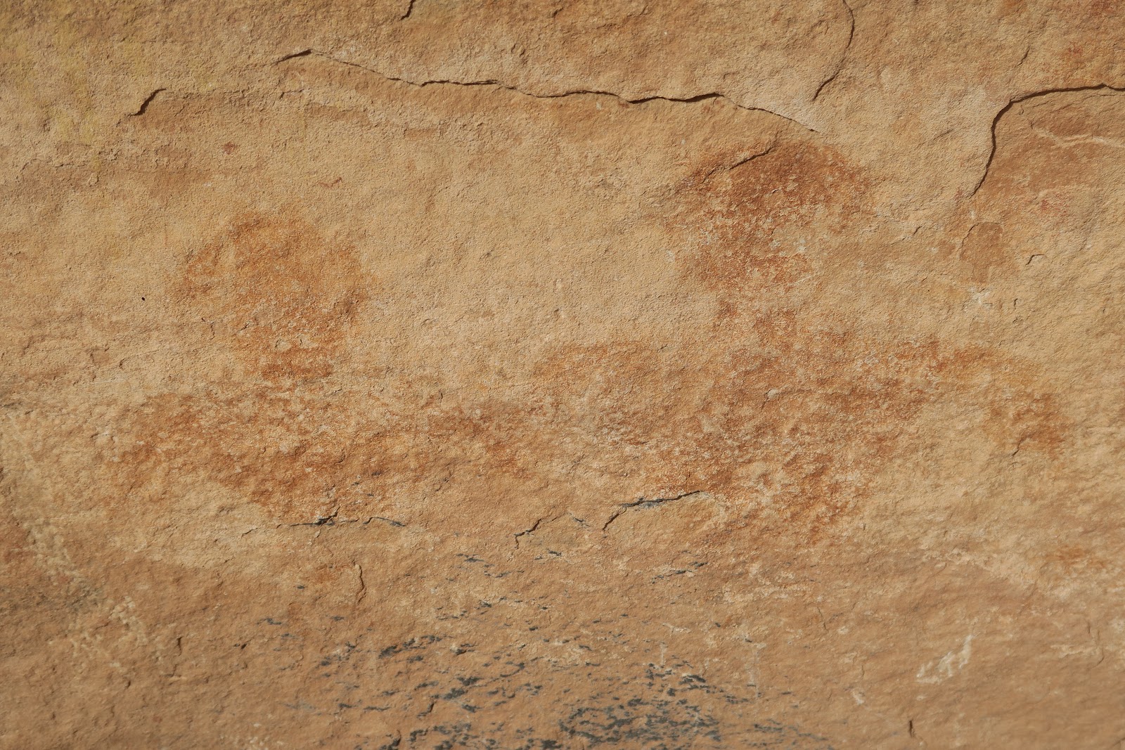
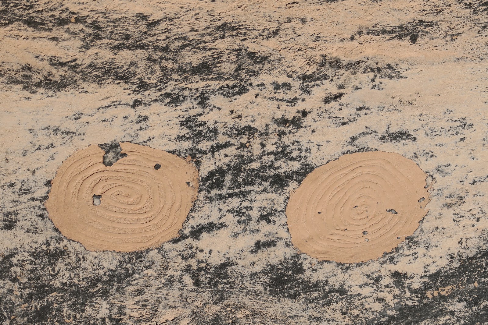
Furthermore, a lot of other drawings are found here as you can see in the above picture. Many colors are used. We spent a fair amount of time here to observe these. Above the wall you can see a lot of brown circles. These are mud balls. It was thought that these circle paint was made by throwing the mud balls. There was some BLM brochure at the site and it was explained that way. Also it said that drawing were made several different time apart. Likely site were occupied for certain time, then empty for while, then again occupied, like that. 

This Green Mask Panel is right before the junction of Shikes Canyon and Grand Gulch. We went to the junction (4 miles from trailhead) and started to trace back. 

 Near the trailhead, we spotted a nice ruin. Somehow we missed when we came in. It was Yellow House Ruin. It consists of several buildings and it is relatively made of yellow-colored rock, that is why I guess called Yellow House Ruin. 


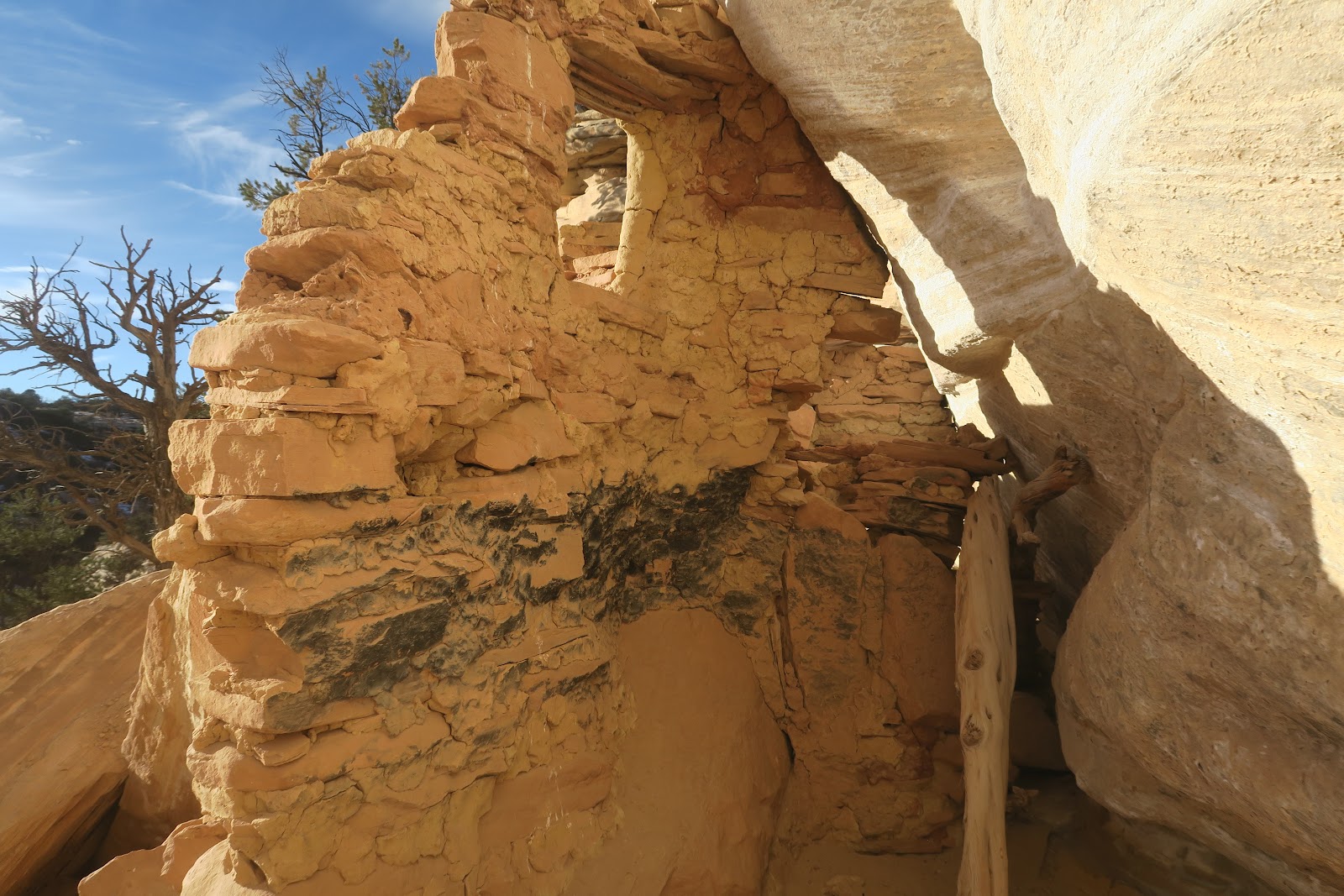
The structure is quite nicely preserved. The roof is impressive. As you can see in the left picture, the lashing is very nicely observed. Neat work. I imagine it would take a lot of time to make these.


Another room is above the first floor. Cool.
A part of inside is black. Probably fire was used in the room. 

We enjoyed the Yellow House Ruin in the evening light and went back to the trailhead.